Herr, Indiana facts for kids
Quick facts for kids
Herr, Indiana
|
|
|---|---|

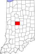
Boone County's location in Indiana
|
|
| Country | United States |
| State | Indiana |
| County | Boone |
| Township | Perry |
| Elevation | 965 ft (294 m) |
| Time zone | UTC-5 (Eastern (EST)) |
| • Summer (DST) | UTC-4 (EDT) |
| ZIP code |
46052
|
| Area code(s) | 765 |
| FIPS code | 18-33196 |
| GNIS feature ID | 436061 |
Herr is a small place in Boone County, Indiana, in the United States. It's known as an unincorporated community. This means it's a group of homes or buildings that isn't officially a town or city with its own local government. Instead, it's part of a larger area, like Perry Township.
Where is Herr Located?
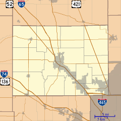
Herr is found in the central part of Indiana. Its exact spot is at coordinates 39 degrees, 57 minutes, 20 seconds North latitude and 86 degrees, 25 minutes, 54 seconds West longitude. This location places it within Boone County.
Understanding Unincorporated Communities
An unincorporated community like Herr doesn't have its own mayor or town council. Services like roads, police, and fire protection are usually managed by the county or township government. People living in Herr still follow the laws of Indiana and the United States.
Boone County, Indiana
Herr is part of Boone County. This county is located in the middle of Indiana. It's known for its mix of rural areas and growing towns. The county seat, which is like the main administrative town, is Lebanon.


