Herring River (Wellfleet, Massachusetts) facts for kids
Quick facts for kids Herring River |
|
|---|---|
|
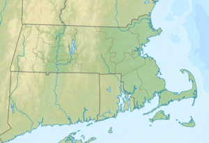
Location of the mouth of the Herring River
|
|
| Other name(s) | Tributary to Wellfleet Harbor |
| Country | United States |
| State | Massachusetts |
| Counties | Barnstable |
| Physical characteristics | |
| Main source | Gull Pond about 2 miles northeast of Wellfleet, MA 6 ft (1.8 m) 41°57′36″N 070°00′34″W / 41.96000°N 70.00944°W |
| River mouth | Wellfleet Harbor Wellfleet, Massachusetts 0 ft (0 m) 41°55′30″N 070°03′28″W / 41.92500°N 70.05778°W |
| Length | 4.93 mi (7.93 km) |
| Basin features | |
| Progression | generally west |
| Basin size | 7.52 square miles (19.5 km2) |
| Population | 2,360 (2010) |
| Tributaries |
|
The Herring River is a special river in Wellfleet, Massachusetts. It's unique because it includes a tidal estuary, which is where fresh river water mixes with salty ocean water. For over a hundred years, a big change to the river caused problems for its plants and animals. But now, exciting plans are in motion to bring the river back to its natural, healthy state!
Contents
About the Herring River
The Herring River is located in Wellfleet, a town in Massachusetts, United States. It's about 4.93 miles (7.93 km) long. The river starts near Gull Pond and flows generally west. It eventually empties into Wellfleet Harbor, which connects to Cape Cod Bay.
What is an Estuary?
An estuary is a special place where a river meets the sea. It's a mix of fresh water from the river and salty water from the ocean. Estuaries are very important ecosystems. They provide homes for many different kinds of plants and animals. These include fish, crabs, birds, and tiny organisms. They also act as nurseries for young marine life.
Why the River Changed
For a long time, the Herring River was a healthy estuary. It had a natural flow of tides that brought in salt water from the ocean. This helped many fish, like herring, to swim upstream to lay their eggs. It also supported a rich variety of plants and animals.
However, in 1909, a large barrier called a dike was built across the river. This dike was put in place to control mosquitoes. It stopped most of the ocean's salty water from flowing into the river's upper parts.
How the Dike Affected the River
Stopping the salt water had a big impact. The areas upstream from the dike became mostly fresh water. This changed the types of plants and animals that could live there. Many species that needed salty or brackish water (a mix of fresh and salt) could no longer survive. The dike also trapped sediments and pollutants, making the river less healthy. This greatly harmed the natural balance of the estuary.
Bringing the River Back to Life
As of 2014, there are big plans and money available to restore the Herring River. The goal is to bring back the natural tidal flow. This means allowing more salt water to enter the river again.
The Restoration Project
The restoration project involves carefully managing the flow of water. Engineers and environmental experts are working together. They plan to make changes to the dike and other structures. This will allow the tides to move freely up and down the river.
Benefits of Restoration
Restoring the tidal flow will have many benefits:
- Improved Habitat: It will bring back the salty and brackish water conditions. This will create healthy homes for many native fish, shellfish, and birds.
- Cleaner Water: The increased tidal flow will help flush out pollutants and sediments. This will make the water cleaner and healthier.
- More Fish: Fish like herring will be able to return to their natural spawning grounds. This helps their populations grow.
- Stronger Ecosystem: A healthy estuary is more resistant to storms and climate change. It also supports a wider variety of life.
The restoration of the Herring River is an exciting project. It shows how people can work to fix environmental problems. It helps bring important natural areas back to life.
 | Aaron Henry |
 | T. R. M. Howard |
 | Jesse Jackson |


