
Hollingbury Castle facts for kids

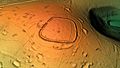
Looking north along the bank on the western side, showing the trig point
|
|

Location in East Sussex
|
|
| Location | Near Brighton, East Sussex |
|---|---|
| Coordinates | 50°51′19″N 0°7′23″W / 50.85528°N 0.12306°W |
| Type | Hillfort |
| Area | 9 acres (3.6 ha) |
| History | |
| Periods | Bronze Age Iron Age |
| Designated | 4 August 1933 |
| Reference no. | 1014526 |
Hollingbury Castle, also known as Hollingbury Camp or Hollingbury Hillfort, is an ancient hillfort from the Iron Age. It is located on the northern edge of Brighton, in East Sussex, England. This historic site is right next to the Hollingbury Park Golf Course. It is protected as a scheduled monument, which means it's a very important historical place.
Contents
What is Hollingbury Castle?
Hollingbury Castle is an old fort built by people living in Britain during the Iron Age. It's called a "hillfort" because it was built on a hill. This gave the people inside a good view of the land around them. It helped them to defend themselves from enemies.
The fort has a single bank and a ditch around it. These are like walls and a moat. The shape is roughly a square with rounded corners. Inside, the fort covers an area of about 9 acres (3.6 ha). There are original entrances on the east and west sides. The western entrance was built with extra turns to make it harder for attackers to get in.
Ancient Burials and Beacons
Inside the fort, there are three Bronze Age bowl barrows. These are ancient burial mounds. They are lined up mostly from north to south near the center of the fort.
People believe that the southernmost barrow was used as a beacon. This means a fire was lit on top of it. This happened during medieval times and even later. The mound is about 14 metres (46 ft) wide and 1 metre (3 ft) high.
Discoveries from Digging Up the Past
Archaeologists have dug up parts of Hollingbury Castle to learn more about it. These digs help us understand how people lived there long ago.
Early Excavations in 1931
One important excavation happened in 1931. A person named E. C. Curwen led this dig. They found out that there was an even older, slightly smaller fort here first.
The eastern side of this older fort can still be seen today. It's a low bank with a filled-in ditch next to it. This older part is about 25 metres (27 yd) inside the main fort's eastern wall. The other sides of the older fort are now hidden under the bigger, later one.
The 1931 dig also found postholes. These are holes where wooden posts once stood. They showed that the fort's walls, called ramparts, were originally like a strong box. They were filled with rubble and made stronger with wooden timbers. There was also a flat area, called a berm, and a ditch outside these timbers. Today, modern posts mark where these ancient postholes were.
Later Discoveries (1967–1969)
More excavations took place between 1967 and 1969. During these digs, archaeologists found the remains of five round houses. These were homes where people lived.
The roundhouses were found in the southwest corner of the fort. They varied in size, from 4.25–12.25 metres (14–40 ft) across. These homes date back to the early 6th century BC.
Images for kids
-
3D view of the digital terrain model

