
Image: Île d'Oléron

Size of this PNG preview of this SVG file: 485 × 599 pixels. Other resolution: 194 × 240 pixels.
Original image (SVG file, nominally 754 × 932 pixels, file size: 369 KB)
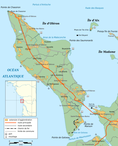
Description: Map of Oléron, Charente-Maritime, France.
Title: Île d'Oléron
Credit: Own work with Inkscape: Towns, borders, roads, coasts: Openstreetmap Harbours and lighthouses: various Wikipedia pages and personal knowledge Locator map from File:France blank.svg (by Sting) Others symbols from File:Maps template-fr.svg
Author: Mutichou
Usage Terms: Creative Commons Attribution-Share Alike 3.0
License: CC BY-SA 3.0
License Link: http://creativecommons.org/licenses/by-sa/3.0
Attribution Required?: Yes
Image usage
The following 2 pages link to this image:

All content from Kiddle encyclopedia articles (including the article images and facts) can be freely used under Attribution-ShareAlike license, unless stated otherwise.