
Île d'Oléron facts for kids

Aerial photograph of Oléron
|
|

Île d'Oléron (France)
|
|
| Geography | |
|---|---|
| Location | Atlantic Ocean |
| Coordinates | 45°54′N 1°18′W / 45.900°N 1.300°W |
| Archipelago | Archipel charentais |
| Area | 175 km2 (68 sq mi) |
| Length | 34 km (21.1 mi) |
| Width | 15 km (9.3 mi) |
| Highest elevation | 34 m (112 ft) |
| Administration | |
|
France
|
|
| Demographics | |
| Demonym | Oléronais(e) |
| Population | 22,032 |
| Pop. density | 126.6 /km2 (327.9 /sq mi) |
Île d'Oléron is a beautiful island located off the Atlantic coast of France. It's west of a city called Rochefort. This island is the second largest in Metropolitan France, only smaller than Corsica. The main town and capital of the island is Saint-Pierre-d'Oléron, which is right in the middle of the island.
Since 1966, a bridge has connected Île d'Oléron to the mainland, making it easy to visit.
Contents
Geography of Île d'Oléron

Île d'Oléron is found on the southern side of a narrow sea passage called the Pertuis d'Antioche strait.
The island is about 34 kilometres (21.1 mi) long and 15 kilometres (9.3 mi) wide. Its total area is around 175 square kilometres (67.6 sq mi). It's a very flat island. The highest point is a dune called the Grande dune de Saint-Trojan, in the southern part of the island. It's only 34 metres (111.5 ft) high.
The island has several important points. The southern tip is Pointe de Gatseau, the northern tip is Pointe de Chassiron, and the eastern tip is Pointe des Saumonards. Close to Pointe des Saumonards is Fort Boyard. This is an old fortification in the Pertuis d'Antioche strait. Today, it's famous for being used in a French TV show with the same name!
Island Climate
The climate on Île d'Oléron is an oceanic climate, which means it's influenced by the ocean. It has mild summers. This type of climate is known as Cfb in the Köppen climate classification system.
On average, Saint-Denis-d'Oléron receives about 777.2 mm (30.6 in) of precipitation each year. The rainiest month is usually December, with around 88.9 mm (3.5 in) of rain. The driest month is August, with only about 40.6 mm (1.6 in) of rain.
The average temperature throughout the year in Saint-Denis-d'Oléron is 13.5 °C (56.3 °F). The warmest month is typically August, with an average temperature of 20.0 °C (68.0 °F). The coolest month is January, with an average temperature of 7.3 °C (45.1 °F).
Island Administration

Administratively, Île d'Oléron is part of the Charente-Maritime department. This department is within the arrondissement of Rochefort. All of these are part of the Nouvelle-Aquitaine region in France.
The island used to be divided into two smaller administrative areas called cantons. These were Canton du Château-d'Oléron and Canton de Saint-Pierre-d'Oléron. Each canton had four communes, which are like small towns or districts. On February 27, 2014, these two cantons were combined. Now, the island has just one canton, called the Canton de l'Île d'Oléron, which includes all 8 communes.
Island Population
The people who live on Île d'Oléron are called Oléronais (for men) or Oléronaises (for women) in French.
In 2014, the population of Île d'Oléron was 22,032 people. This means there were about 125.9 inhabitants per square kilometer. The largest town on the island is Saint-Pierre-d'Oléron, with 6,694 people in 2014.
Gallery
-
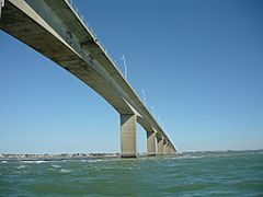
The bridge of Oléron
-
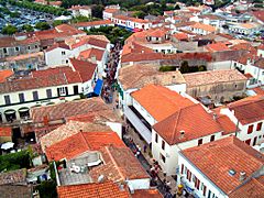
Saint-Pierre-d'Oléron, view from the church tower
-
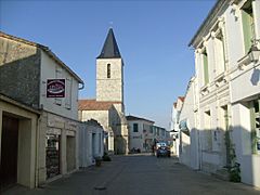
Dolus-d'Oléron downtown
-
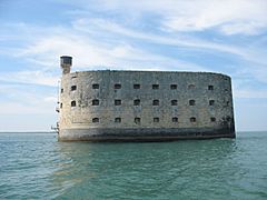
Fort Boyard
-
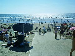
Le Grand-Village-Plage


Images for kids
-
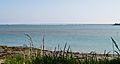
Île d'Oléron bridge, seen from Le Château d'Oléron
-
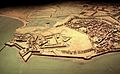
Le Château-d'Oléron, 1703 military mock-up.


Related pages
See also
 In Spanish: Isla de Oleron para niños
