
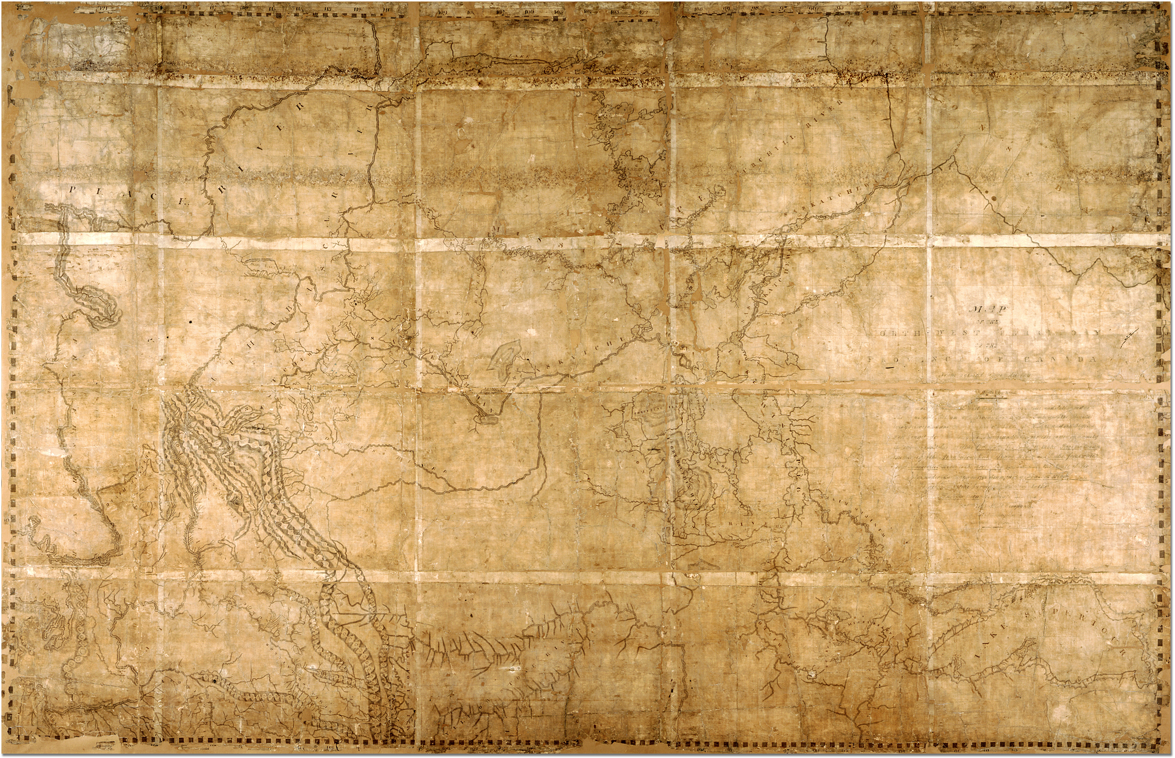
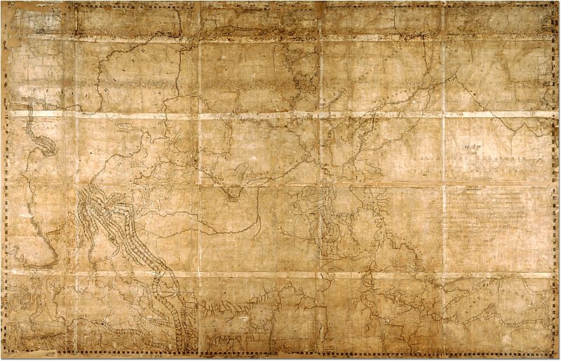
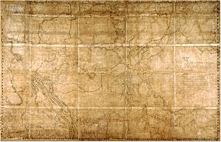
Image: 1814ThompsonMap
Description: Map of the North-West Territory of the Province of Canada by David Thompson, 1814 Archives of Ontario, I0012850 Map is in the public domain. See:http://ao.minisisinc.com/scripts/mwimain.dll/144/ARCH_DESC_FACT/FACTSDESC/REFD%2BF%2B443-6?SESSIONSEARCH Full Title: "Map of the North-West Territory of the Province of Canada from actual Survey during the years 1792-1812. This map made for the North West Company in 1813 and 1814 and delivered to the Honorable William McGillivray then agent Embraces the Region lying between 45 and 60 degrees North Latitude and 84 and 124 degrees West Longitude comprising the Survey's and Discoveries of 20 years namely the Discovery and Survey of the Oregon Territory to the Pacific Ocean the Survey of the Athabasca Lake Slave River and Lake from which flows Mackenzie's River to the Arctic Sea by Mr. Philip Turner the Route of Alexander Mackenzie in 1792 down part of Fraser's river together with the Survey of this River to the Pacific Ocean by the late John Stuart of the North-West Company by David Thompson Astronomer and Surveyor."
Usage Terms: Public domain
Image usage
The following 2 pages link to this image:
