David Thompson (explorer) facts for kids
Quick facts for kids
David Thompson
|
|
|---|---|
 |
|
| Born | 30 April 1770 Westminster, England
|
| Died | 10 February 1857 (aged 86) Longueuil, Canada East
|
| Occupation | Explorer and Map Maker |
| Spouse(s) | Charlotte Small |
| Children | Fanny (1801), Samuel (1804), Emma (1806), John (1808), Joshuah (1811), Henry (1813), Charlotte (1815), Elizabeth (1817), William (1819), Thomas (1822), George (1824), Mary (1827), Eliza (1829) |
| Parent(s) | David and Ann Thompson |
| Signature | |
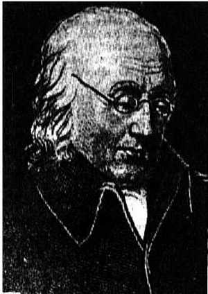
David Thompson (born April 30, 1770 – died February 10, 1857) was a famous British-Canadian explorer and mapmaker. He was also a fur trader and surveyor. Some Indigenous peoples called him Koo-Koo-Sint, meaning "the Stargazer".
Thompson traveled about 90,000 kilometers (56,000 miles) across North America. He mapped a huge area of 4.9 million square kilometers (1.9 million square miles). This amazing work led many to call him the "greatest practical land geographer" ever.
Contents
Early Life and Education
David Thompson was born in Westminster, England. His parents were David and Ann Thompson, who had recently moved from Wales. When David was only two years old, his father died.
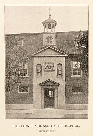
His mother faced financial difficulties. So, on April 29, 1777, just before his seventh birthday, David and his older brother went to the Grey Coat Hospital. This was a school for children from poor families in Westminster.
David later joined the Grey Coat mathematical school. This school was well-known for teaching navigation and surveying. He learned skills for the Royal Navy, including math like trigonometry and geometry. He also learned how to use navigation tools. This included finding locations using the sun, moon, and tides. He also learned to draw maps and measure land. These skills helped him greatly in his future career.
In 1784, at age 14, Thompson became an apprentice for the Hudson's Bay Company. He signed a contract to work for seven years. He was trained to be a clerk. On May 28, 1784, he left England for North America.
Working for the Hudson's Bay Company
On September 2, 1784, Thompson arrived in Churchill, Manitoba. He started working as a clerk and secretary. He copied papers for the governor of Fort Churchill, Samuel Hearne.
The next year, he moved to York Factory. Over the next few years, he worked at other fur trading posts. These included Cumberland House, Saskatchewan and South Branch House. He arrived at Manchester House in 1787. During this time, he learned to manage accounts and records. He also learned to calculate the value of furs and track supplies.
In December 1788, Thompson broke his leg badly. He had to spend the next two winters recovering at Cumberland House. During this time, he greatly improved his math, astronomy, and surveying skills. He was taught by Philip Turnor, a surveyor for the Hudson's Bay Company. It was also during this time that he lost sight in his right eye.
In 1790, his apprenticeship was ending. Thompson asked for surveying tools instead of the usual gift of fine clothes. He received both. He then became a fur trader for the Hudson's Bay Company. In 1792, he completed his first important survey. He mapped a route to Lake Athabasca, near today's Alberta/Saskatchewan border.
Thompson was very skilled at map-making and surveying. Because of this, the company promoted him to surveyor in 1794. He worked for the Hudson's Bay Company until May 23, 1797. He was told to stop surveying and focus only on fur trading. This made him frustrated, so he left the company. He walked 80 miles (130 km) in the snow to join their rival, the North West Company. There, he continued his work as a fur trader and surveyor.
Joining the North West Company
Thompson's old employers were not happy he left without notice. But the North West Company (NWC) supported his surveying and mapping work. They knew it was important to map their settlements. This helped them know exactly where their posts were and how far apart they were.
In 1797, the NWC sent Thompson south. His job was to survey part of the Canada-US border. This was along the water routes from Lake Superior to Lake of the Woods. This was to help settle land questions from the Jay Treaty. This treaty was signed after the American Revolutionary War.
By 1798, Thompson had surveyed 6,750 km (4,190 mi) of land. This included areas from Grand Portage to Lake Winnipeg. He also mapped the headwaters of the Assiniboine River and Mississippi River. He also mapped two sides of Lake Superior.
In 1798, the company sent him to Red Deer Lake (now Lac La Biche in Alberta). His task was to set up a trading post there. Thompson spent the next few years trading from Fort George in Alberta. During this time, he led several trips into the Rocky Mountains.
In July 1804, Thompson became a full partner of the North West Company. He was a "wintering partner," meaning he worked in the field, not in Montreal. He managed fur trading operations. He also found time to expand his surveys around Lake Superior.
In 1806, the company decided to send Thompson back into the interior. They were worried about the American Lewis and Clark Expedition. So, the North West Company asked Thompson to find a route to the Pacific Ocean. This would open up new fur trading areas in the Pacific Northwest.
Exploring the Columbia River
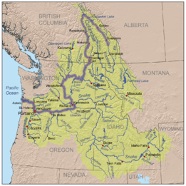
After the 1806 meeting, Thompson went to Rocky Mountain House. He got ready for a trip to follow the Columbia River to the Pacific. In June 1807, Thompson crossed the Rocky Mountains. He spent the summer mapping the Columbia basin. He continued to survey this area for the next few years.
Thompson mapped and set up trading posts in Montana, Idaho, Washington, and Western Canada. Some posts he founded were Kootenae House, Kullyspell House, and Saleesh House. The last two were the first trading posts west of the Rockies in Idaho and Montana. These posts helped the North West Company expand its fur trading into the Columbia River area. His maps of the Columbia River basin were so good that they were still useful in the 1900s.
In early 1810, Thompson was traveling back east toward Montreal. But at Rainy Lake, he received new orders. He was told to return to the Rocky Mountains. His new mission was to find a route to the mouth of the Columbia River. The North West Company was reacting to John Jacob Astor's plans. Astor wanted to send a ship to set up a fur trading post on the Pacific Coast.
On his return trip, Thompson was stopped by a group of Peigan Indigenous people at Howse Pass. He had to find a new way across the Rocky Mountains. He found a route through the Athabasca Pass.
David Thompson was the first European to travel the entire length of the Columbia River. Between Kettle Falls (July 3, 1811) and the joining of the Columbia and Snake Rivers (July 9), he traveled through areas no European had seen. He took time to visit villages along the way. He wanted to build good relationships, helped by giving out lots of tobacco.
In 1805, Lewis and Clark had traveled down the Snake River and then the Columbia. When Thompson reached the river junction, he put up a pole. He left a notice claiming the land for Great Britain. It also said the North West Company planned to build a trading post there. Later that year, Astor's company workers found this notice. This helped them choose a more northern spot for their post at Fort Okanogan. The North West Company built its post, Fort Nez Percés, near the Snake River later.
Thompson continued down the Columbia. He passed over the Celilo Falls, almost losing his canoe. He carried his canoe around the rapids of The Dalles and the Cascades Rapids. On July 14, 1811, Thompson reached the partly built Fort Astoria. This was at the mouth of the Columbia. He arrived two months after the Pacific Fur Company's ship, the Tonquin.
Before heading back upriver and across the mountains, Thompson hired Naukane. Naukane was a Native Hawaiian worker. He had been brought to Fort Astoria by the Tonquin ship. Naukane, also known as Coxe to Thompson, traveled with Thompson across North America to Lake Superior. He then continued his journey to England.
Thompson spent the winter at Saleesh House. Then, in 1812, he began his final trip back to Montreal. The North West Company was based there.
In his published journals, Thompson wrote about seeing large footprints in 1811. These were near what is now Jasper, Alberta. He said they measured 14 inches long and 8 inches wide. Some people have suggested these prints were like what is now called the sasquatch. However, Thompson noted that these tracks had "a small Nail at the end of each [toe]". He also said they "very much resembles a large Bear's Track".
The years from 1807 to 1812 are very important in Thompson's career. This is because he created commercial routes across the Rockies. He also mapped the lands they crossed.
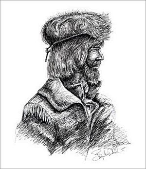
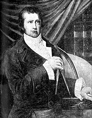
What David Thompson Looked Like
In 1820, a geologist named John Jeremiah Bigsby met David Thompson. He described Thompson in his book The Shoe and Canoe.
Bigsby said Thompson was about 50 years old. He was dressed simply, quiet, and observant. He was short and strong. His black hair was long all around and cut straight above his eyebrows. His face was a reddish-brown, like a gardener's. His deep lines showed he was friendly and smart. His short nose gave him an unusual look. His speech showed he was from Wales, even though he left there when he was very young.
Bigsby also said that Thompson had a very powerful mind. He could describe a wilderness with fighting Indigenous people. He could also make you feel like you were climbing the Rocky Mountains in a snowstorm. He made it so real that you could almost hear a rifle or feel snowflakes melt on your cheeks as he talked.
Family Life
On June 10, 1799, at Île-à-la-Crosse, Thompson married Charlotte Small. She was a 13-year-old Métis girl. Her father was a Scottish fur trader, and her mother was Cree. Their marriage was officially recognized 13 years later. This happened at the Scotch Presbyterian Church in Montreal on October 30, 1812.
David and Charlotte had 13 children together. Five of them were born before he left the fur trade. The family found it hard to adjust to life in Eastern Canada. They lived in Montreal while David was traveling. Two of their children, John (age 5) and Emma (age 7), died from an illness. By the time Thompson died, he and Charlotte had been married for 57 years. This was the longest marriage known in Canada before it became a country.
Later Years and Legacy
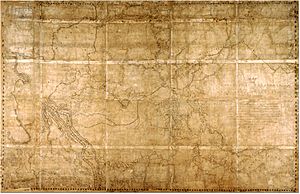
When Thompson returned to Montreal, he retired. He received a good pension from the North West Company. He settled in nearby Terrebonne. There, he worked on his great map. This map summarized his life of exploring and surveying North America. The map covered a huge area from Lake Superior to the Pacific Ocean. Thompson gave this map to the North West Company.
Thompson's 1814 map was his greatest achievement. It was so accurate that 100 years later, it was still used as a basis for many Canadian government maps. This map is now kept in the Archives of Ontario.
In 1815, Thompson moved his family to Williamstown, Ontario. A few years later, he was hired to survey the new borders with the United States. These borders stretched from Lake of the Woods to the Eastern Townships of Quebec. They were set by the Treaty of Ghent after the War of 1812. In 1843, Thompson finished his atlas of the region. This atlas covered the area from Hudson Bay to the Pacific Ocean.
After this, Thompson returned to being a landowner. But he soon faced financial problems. By 1831, he was deeply in debt. He had to take a job as a surveyor for the British American Land Company to support his family. His bad luck continued. In 1845, he had to move in with his daughter and son-in-law. He started writing a book about his life exploring the continent. But he could not finish it because he lost his sight completely in 1851.
Death and Recognition
Thompson mapped a land area of 3.9 million square kilometers (1.5 million square miles). This is about one-fifth of the entire continent. Another great explorer, Alexander Mackenzie, said that Thompson did more in ten months than he thought possible in two years.
Despite his huge achievements, Thompson died in Montreal on February 10, 1857. He was almost unknown at the time. He never finished his book about his 28 years in the fur trade. This book was based on his 77 field notebooks.
In the 1890s, a geologist named J.B. Tyrrell found Thompson's notes. In 1916, he published them as David Thompson's Narrative. Later editions and studies of Thompson's life were published in 1962, 1971, and 2015.
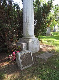
Thompson was buried in Montreal's Mount Royal Cemetery in an unmarked grave. It wasn't until 1926 that a tombstone was placed on his grave. This was thanks to the efforts of J.B. Tyrrell and the Canadian Historical Society. The next year, Thompson was named a National Historic Person by the Canadian government. This was one of the first times someone received this honor. A plaque about this is in Jasper National Park, Alberta.
Thompson's achievements are also why other places are recognized as national historic sites:
- David Thompson on the Columbia River National Historic Event, marked at Castlegar, BC
- Athabasca Pass National Historic Site (NHS), at Jasper National Park
- Boat Encampment NHS, BC
- Howse Pass NHS, Banff National Park, Alberta
- Kootenae House NHS, BC
- Rocky Mountain House NHS, Alberta
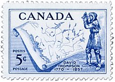
In 1957, 100 years after his death, Canada Post honored him with his image on a postage stamp. The David Thompson Highway in Alberta is named after him. There is also David Thompson High School near Leslieville, Alberta. Two other schools, one in Vancouver, BC, and one in Invermere, BC, are also named after him.
His skill as a geographer is now well-known. He has been called "the greatest land geographer that the world has produced."
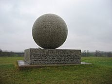
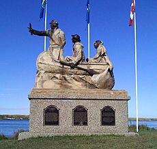
There is a monument dedicated to David Thompson in North Dakota. It is near the former town of Verendrye, North Dakota. Thompson Falls, Montana, and British Columbia's Thompson River and Thompson Falls on the Blaeberry River are also named after him.
The year 2007 marked 150 years since Thompson's death. It was also 200 years since he first crossed the Rocky Mountains. Special events and exhibits were held across Canada and the United States from 2007 to 2011. These celebrated his accomplishments.
In 2007, a plaque was placed at the Grey Coat Hospital in England. This was the school David Thompson attended as a boy. It was placed by English author and TV presenter Ray Mears.
Thompson was the subject of a 1964 National Film Board of Canada short film. It was called David Thompson: The Great Mapmaker. He was also featured in the BBC2 program Ray Mears' Northern Wilderness (Episode 5) in November 2009. He is also the subject of a 2010 KSPS-TV film called Uncharted Territory: David Thompson on the Columbia Plateau.
He is mentioned in the 1981 folk song "Northwest Passage" by Stan Rogers.
In 2018, Parks Canada announced they named their new research ship RV David Thompson. This ship will be used for underwater archaeology, including mapping the sea floor. It will also do marine science in the Pacific, Atlantic, and Arctic Oceans, and the Great Lakes. It will be the main ship for research on the Wrecks of HMS Erebus and HMS Terror National Historic Site.
The David Thompson Astronomical Observatory at Fort William Historical Park was named to honor David Thompson and his discoveries.
See also
 In Spanish: David Thompson (cartógrafo) para niños
 | Jackie Robinson |
 | Jack Johnson |
 | Althea Gibson |
 | Arthur Ashe |
 | Muhammad Ali |


