Celilo Falls facts for kids
Quick facts for kids Celilo Falls |
|
|---|---|
| Wyam | |
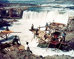
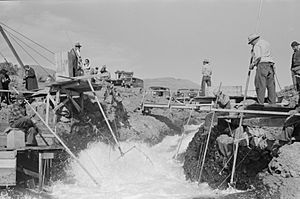
Dipnet fishing at Celilo Falls in the 1950s
|
|
| Lua error in Module:Infobox_mapframe at line 185: attempt to index field 'wikibase' (a nil value). | |
| Location | Between Wasco County, Oregon and Klickitat County, Washington |
| Coordinates | 45°38′58″N 120°58′41″W / 45.64945°N 120.97792°W |
| Type | Segmented steep cascade; submerged since 1957 |
| Watercourse | Columbia River |
Celilo Falls was a very important place on the Columbia River. It was located where the states of Oregon and Washington meet today. Its native name was Wyam, which means "echo of falling water."
For about 15,000 years, Celilo Falls was a major fishing and trading spot for Native American tribes. It was the oldest community in North America that was always lived in. But in 1957, the falls and nearby villages were covered by water when The Dalles Dam was built. In recent years, tribal leaders have asked for the falls to be brought back.
Contents
What Celilo Falls Looked Like
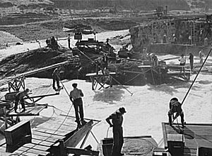
Celilo Falls was a powerful series of waterfalls and rapids. It was also known by names like The Chutes or Great Falls. The mighty Columbia River, usually over a mile wide, was squeezed into a narrow channel here. At its narrowest, the river was only about 140 feet (43 meters) wide.
The height of the falls changed with the seasons. When the water was low, the falls dropped about 20 feet (6 meters). But during spring floods, the water could rise so much that the falls were completely covered! Celilo Falls was one of the largest waterfalls in North America by the amount of water flowing over it.
The falls were part of a longer stretch of rapids called The Narrows or The Dalles. This area stretched for about 12 miles (19 kilometers) downstream. The river dropped a lot over this distance, creating many fast-moving sections. Early explorers often wrote about how wild and dangerous these rapids were. One explorer called it "one of the most remarkable places upon the Columbia."
A Place of History and Culture
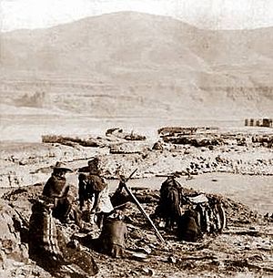
For thousands of years, Native American people gathered at Wyam. They came to fish for salmon and trade goods. They built special wooden platforms over the water. From these platforms, they used dipnets and long spears to catch salmon swimming upstream. It's thought that 15 to 20 million salmon passed through the falls each year. This made it one of the best fishing spots anywhere.
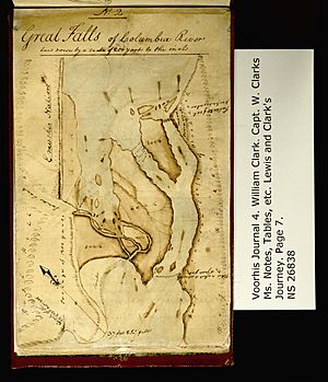
Celilo Falls was also a central trading hub. It was located between different language groups, like the Chinookan and Sahaptian speakers. People traded goods from as far away as the Great Plains, the Southwest, and Alaska. This shows that Celilo was a melting pot of cultures. When the Lewis and Clark Expedition visited in 1805, they found a busy "great meeting place" with many people. Historians have even called the Celilo area the "Wall Street of the West" because of all the trading.
Traveling the River
The changing water levels of the Columbia River made travel difficult. When the water was low, Celilo Falls was a huge barrier. But when the water was high during floods, the falls could be smooth and easy to pass. However, other rapids downstream, like the Long Narrows, became very dangerous during high water. Many early American pioneers lost their lives trying to travel through these strong currents.
To help with river travel, the Army Corps of Engineers built the 14-mile (23 km) Celilo Canal in 1915. This canal allowed steamboats to go around the falls. But it was not used much and closed just a few years later.
The Dam and Its Impact
In the 1930s and 1940s, more people moved to the Pacific Northwest. Leaders wanted to build a system of hydroelectric dams on the Columbia River. They believed dams would help ships travel, provide water for farms, create electricity for industries, and stop floods.
The huge amount of water at Celilo Falls made it a good spot for a new dam. This dam would be called The Dalles Dam. Even though Native American tribes had treaties from 1855 that protected their fishing rights at Celilo, the government decided the dam would not break these rights. They paid the tribes $26.8 million for the loss of their fishing sites.
The Army Corps of Engineers started building The Dalles Dam in 1952. It was finished five years later. On March 10, 1957, many people watched as the rising waters of Lake Celilo covered the falls. The fishing platforms and the village of Celilo disappeared underwater. This ended a way of life that had lasted for thousands of years. Today, a small Native American community still lives at nearby Celilo Village, looking over where the falls once were.
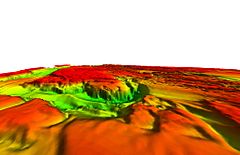
In 2008, the Army Corps of Engineers used sonar technology to survey the site. They found that the falls are still there, intact, beneath the lake. The rocky shapes and channels match old photos from the 1940s.
Legacy and Future
Celilo Falls is still very important to Native American people. Many feel a deep connection to the falls, even though they are underwater. As one tribal leader said, "If you are an Indian person and you think, you can still see all the characteristics of that waterfall. If you listen, you can still hear its roar." In 2007, thousands of people gathered at Celilo Village to remember the 50th anniversary of the falls being flooded.
Artist and architect Maya Lin has created artwork at Celilo as part of the Confluence Project. This project helps tell the story of the Columbia River and its people.
Calls for Restoration
In 2019, leaders from the Yakama Nation and Lummi Nation asked for Celilo Falls to be restored. They pointed out that Native peoples never agreed to the falls being covered. They also noted that the dam has made the river warmer and caused a big drop in salmon numbers. They said the dam destroyed fishing sites that were promised to tribes in treaties over 150 years ago. However, some groups argue that the dam is still important for producing hydropower electricity for local businesses and ports.
Images for kids
 | Jewel Prestage |
 | Ella Baker |
 | Fannie Lou Hamer |


