Kootenay River facts for kids
Quick facts for kids Kootenay |
|
|---|---|
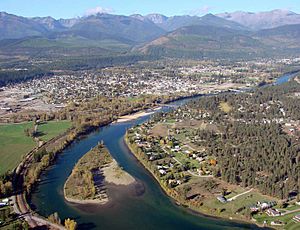
The Kootenay (Kootenai) River at Libby, Montana
|
|
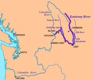
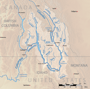
Map of the Kootenay River, its main tributaries and lakes, and major cities.
|
|
| Other name(s) | Kootenai, Flatbow, Swan |
| Countries | Canada, United States |
| Province | British Columbia |
| State | Montana |
| Cities | Libby, MT, Bonners Ferry, ID, Creston, BC, Nelson, BC, Castlegar, BC |
| Physical characteristics | |
| Main source | South flank of Castle Mountain Beaverfoot Range, Kootenay National Park, British Columbia, Canada 2,261 m (7,418 ft) 51°02′21″N 116°26′33″W / 51.03917°N 116.44250°W |
| River mouth | Columbia River Castlegar, British Columbia, Canada 420 m (1,380 ft) 49°19′0″N 117°39′4″W / 49.31667°N 117.65111°W |
| Length | 780 km (480 mi) |
| Basin features | |
| Basin size | 50,298 km2 (19,420 sq mi) |
| Tributaries |
|
The Kootenay River (called Kootenai in the U.S.) is a big river in the Pacific Northwest. It flows through southeastern British Columbia in Canada, and northern Montana and Idaho in the United States. It's one of the main rivers that feeds into the Columbia River. The Columbia River is the largest North American river that flows into the Pacific Ocean.
The Kootenay River is about 781 kilometers (485 miles) long. It starts in the Canadian Rockies in British Columbia. Then it flows into Montana, turns west into Idaho, and finally goes back into British Columbia. It joins the Columbia River at Castlegar.
This river gets its water mainly from melting glaciers and snow. It drains a large area of over 50,000 square kilometers (19,000 square miles). More than 70 percent of this area is in Canada. From its start to where it meets the Columbia River, the Kootenay drops more than 2,000 meters (6,600 feet). This makes it a very steep river with many waterfalls and rapids.
Part of the lower Kootenay River forms Kootenay Lake. This is one of the biggest natural lakes in British Columbia. The Ktunaxa people were the first to live along the Kootenay River. They hunted and fished there for hundreds of years.
In the 19th century, a Canadian explorer named David Thompson was the first European to explore the Kootenay. He set up trading posts in the area. Later, gold, silver, and lead were discovered. This brought thousands of miners and settlers to the region. Railroads and steamboats soon followed.
Many dams were built on the Kootenay in the 20th century. These dams generate electricity and help control floods and droughts. Today, over 150 kilometers (93 miles) of the river are held back by five dams. A sixth dam controls the level of Kootenay Lake.
Contents
River Names and Their Meanings
The local Ktunaxa (Kootenai) people had different names for the river. Those living along the upper river called it aqkinmiluk, which simply means "river." People along the lower river called it aqkoktlaqatl, but its meaning is not clear.
The name "Flatbow River" came from the Blackfeet tribe. They used this name for the Ktunaxa because of their "powerful, stylish bows." French-Canadian fur traders later wrote down this name.
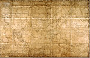
Explorer David Thompson was looking for the source of the Columbia River. He found Columbia Lake, where the Columbia starts as a small stream. The Kootenay, however, was already a powerful river flowing south. Thompson thought the Columbia was the Kootenay. He named the real Kootenay "McGillivray’s River" after his trading partners.
The name "Kootenai" was also used by French Canadians in the 19th century. It referred to the Ktunaxa people. "Kootenai" might mean "water people" in an Algonquian language. In the United States, the river is still called Kootenai. In Canada, where most of the river flows, it's spelled Kootenay.
Old maps from the U.S. Geological Survey (USGS) show other names. These include "Kootanie," "Kootenie," and "Kootienay." "Swan River" is also listed as an alternate name, but its origin is unknown.
Where the Kootenay River Flows
The Kootenay River starts on the northeast side of the Beaverfoot Range in British Columbia. It first flows southeast through a marshy valley in Kootenay National Park. The river gets much bigger when the Vermilion River joins it. This happens near Kootenay Crossing.
The Kootenay continues southeast, with the Palliser River joining from the left. It then flows south into a deep gorge where the White River meets it. Near Canal Flats, the Kootenay River comes very close to Columbia Lake. This lake is where the Columbia River begins.
The Kootenay then enters the Rocky Mountain Trench. It receives the St. Mary and Wild Horse rivers near Fort Steele. The Bull River also joins it. At Wardner, British Columbia, the Kootenay widens into Lake Koocanusa. This large reservoir was formed by the Libby Dam in Montana. The Elk River, the Kootenay's longest branch, flows into Lake Koocanusa.
Below Libby Dam, the river is called the Kootenai. It makes a big bend around the south side of the Purcell Mountains. The Fisher River joins it from the south, and the Kootenai turns west past Libby, Montana. About 15 kilometers (9 miles) downstream from Libby, it flows over Kootenai Falls.
The river then turns northwest at Troy. The Yaak River and Moyie River join it from the north. In Idaho, the river enters the flat Kootenai Valley. It turns north at Bonners Ferry.
The Kootenai re-enters Canada and becomes the Kootenay again south of Creston, British Columbia. It flows through a marshy area called the Kootenay Flats. Then it empties into the 100-kilometer (62-mile) long Kootenay Lake. The Duncan River, the largest branch by water volume, also flows into this lake.
Near Balfour, a part of the lake branches west to Nelson. The Kootenay River flows out of the lake below Corra Linn Dam. The last part of the river flows west through a deep canyon. Here, it forms several waterfalls, including Bonnington Falls. Four dams use this part of the river to make electricity. At Brilliant, the Kootenay forms a small delta. Finally, at Castlegar, it joins the Columbia River.
The Kootenay River's Watershed
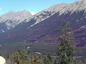
A river's watershed is the area of land where all the water drains into that river. The Kootenay River's watershed is about 50,298 square kilometers (19,420 square miles). It's one of the biggest parts of the larger Columbia Basin. This area is almost 400 kilometers (250 miles) long and 250 kilometers (155 miles) wide. It's often called the Kootenays.
More than 70 percent of the Kootenay's watershed is in Canada. The parts in Montana and Idaho make up 23 and 6 percent, respectively. The Kootenay is special because it starts in one country (Canada), crosses into another (U.S.), and then returns to the first (Canada).
The Kootenay River watershed has many rocky uplands and steep mountains. There isn't much flat land. Most of the flat areas are in the narrow Kootenay River valley near Bonners Ferry and Kootenay Lake. The mountains in this region usually run from northwest to southeast. They create steep valleys where the rivers flow.
The 206-kilometer (128-mile) long Duncan River is the Kootenay's largest branch. Many other smaller rivers also join the Kootenay. These include the Vermilion, Palliser, White, Elk, Fisher, Yaak, Moyie, and Slocan rivers.
How the River Changes the Land
The story of the Kootenay River's land is linked to the Columbia, Selkirk, and Rocky Mountains. The mountains in the Kootenay River area are mostly made of old, hard rocks. These rocks are very strong and don't wear away easily.
The Rocky Mountain Trench is a long, narrow strip of land that has dropped over time. This happened because of cracks in the Earth's crust called faults. These faults in the Kootenay River watershed usually run from north-northwest to south-southeast.
The riverbed in the upper and lower parts of the Kootenay is mostly solid rock. But in the middle, the river flows over loose sediments. This allows the river to meander (curve and wind) across a wider valley. These sediments probably came from heavy glaciers during the last Ice Age.
About 15,000 years ago, a huge ice sheet called the Cordilleran Ice Sheet moved south. It blocked the Kootenay River where Kootenay Lake is now. Glaciers covered most of the northern Kootenay River watershed. They shaped the mountains and valleys we see today. The glacier that formed Kootenay Lake caused the river to back up into a huge body of water. This water stretched all the way to Libby, Montana. After the glaciers melted, Kootenay Lake shrank to its current size. The Kootenay Flats, a marshy area, were also formed.
History of the Kootenay River
First People Along the River
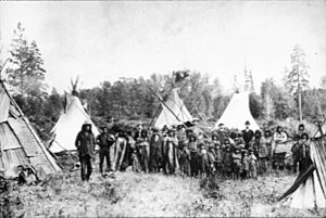
The first people to live in the Kootenay River valley were the Ktunaxa people. The river's name comes from them. Ktunaxa stories say their people were created by a supreme being. They have always lived in this beautiful land.
However, some evidence suggests they came from the Great Plains. They might have been pushed out by the Blackfeet in the 16th century. The Ktunaxa were quite separate from other tribes in the Pacific Northwest. Their language is unique and not closely related to others.
They were semi-nomadic, meaning they moved around. They lived in a large area of the Kootenay valley. In winter, they stayed in four villages. The rest of the year, they traveled to fish, hunt, and pick berries. Northern Ktunaxa hunted buffalo, while southerners mainly fished. The Ktunaxa were the first tribe west of the Rockies to use horses.
The meaning of "Kootenai" is not fully known. Before Europeans arrived, they were called Ksanka, meaning "people of the standing arrow." French-Canadian fur trappers in the early 19th century might have first called them Kootenai. This could mean "water people" or "deer robes." Other tribes in the area included the Montana Salish and Shuswap.
Early Explorers
In 1806, explorer David Thompson set out from Saskatchewan to find the source of the Columbia River. He crossed the Canadian Rockies and reached the Kootenay. He thought it was the Columbia. He traveled down the river but turned back after being attacked by Native Americans.
The next year, Thompson and his group tried again. They found Columbia Lake and set up a trading post called Kootenae House. In 1808, he explored the Kootenay River further. He reached Montana and Idaho, setting up more trading posts. Thompson continued to trade furs in the Kootenay region. He was known for not allowing alcohol to be brought across the mountains.
John Palliser explored the Rockies in 1858. He found the source of the Palliser River, which is now named after him. His group had trouble returning to Alberta. They traded for horses and supplies from the Ktunaxa. His expeditions were important for mapping the region.
In 1859, Palliser traveled into the Kootenay River valley. He was looking for a good path for a trade route or railroad. He was told a trail existed but was too rough for horses. His expedition cleared the trail, which later became the route for the Canadian Pacific Railway.
Gold and Silver Rush

In 1863, gold was found where the Wild Horse and Kootenay Rivers meet. This started the Wild Horse Gold Rush. Thousands of miners came to the area. A gold rush town called Fisherville was built. It had to be moved because it was on top of rich gold deposits.
Most of the gold was mined out by 1864. By 1865, the rush was over. Many miners moved to other gold fields. Fisherville continued for a few years, mostly with Chinese miners. They worked the claims that others had left. Fisherville was eventually abandoned.
Other gold rushes happened on the Moyie and Goat Rivers. Then, silver and galena (a type of lead ore) were found near Kootenay Lake. This led to the rapid growth of towns like Nelson and Kaslo. By 1889, a smelter was built near the Kootenay's mouth to process the ore. Steamboats carried goods and people on the Kootenai River and Kootenay Lake.
Steamboats on the River
When the Canadian Pacific Railway (CPR) finished its line, steamboats began to operate on the Columbia and Kootenay Rivers. They carried passengers, goods, and ore. The total route was about 500 kilometers (310 miles) long. It went from Golden in the north to Jennings, Montana, in the south. There was a short land transfer at Canal Flats. The steamboat era on the Kootenay lasted only about 28 years.
In 1882, William Adolf Baillie-Grohman suggested building a canal. This canal would connect the Kootenay River and Columbia Lake. It would help navigation and control floods. The 2-kilometer (1.2-mile) long Baillie-Grohman Canal was finished in 1889. It had one lock.
Operating steamboats on the Kootenay was very hard. The river had rough waters, especially in Jennings Canyon. Two early steamers, the Duchess and the Cline, sank. The first steamboat to actually run the Kootenay was the Annerly in 1893.
The Gwendoline was another steamboat. Its builder, Captain Frank P. Armstrong, tried to take it to Golden. But the canal was blocked by a flood. He had to move the ship over land. The Gwendoline was the only ship to travel through the canal properly.
The last ship to pass through the canal was the North Star in 1902. Captain Armstrong decided to move it to the Columbia River. Business on the Kootenay was slowing down. The canal was in bad shape and too small. Armstrong built temporary dams to create a larger lock. This allowed the North Star to pass. This marked the end of the steamboat era on the Kootenay.
Doukhobor Settlement
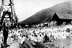
In the early 20th century, a Russian religious group called the Doukhobors faced problems in Saskatchewan, Canada. Their leader, Peter Verigin, decided to move them to British Columbia in 1909. He bought land at the mouth of the Kootenay River, where it joins the Columbia. He named the settlement Brilliant, for the "sparkling waters." By 1913, over 5,000 Doukhobors lived there.
The Doukhobors cleared land and built homes. They also built sawmills to process lumber. They constructed large houses that held many families. They also built a brick factory. Brilliant was one of the first cities in the area to have running water. They built a reservoir to hold water from the Kootenay River. In 1913, they started a jam and marmalade factory. They also built a ferry and a suspension bridge across the Columbia River. Brilliant became important for the region's lumber industry.
However, problems arose. In the 1920s, some schools in Brilliant were burned down. In 1924, Peter Verigin was killed in a train explosion. Over 7,000 people attended his funeral. He was buried in a special tomb overlooking Brilliant and the rivers.
His son, Peter P. Verigin, took over in 1927. But a terrible economic depression caused the Doukhobors to lose most of their land. Verigin Jr. died in 1939. By 1963, almost all Doukhobor lands were sold. Today, only Verigin's tomb remains of the settlement. The Doukhobor suspension bridge still stands and is a National Historic Site of Canada.
Nature and Wildlife
The Kootenay River watershed has many different natural areas. These include rivers, lakes, wetlands, grasslands, and forests. Forests cover most of the high mountains. Grasslands are found in the lower valleys, especially around Lake Koocanusa. In Canada, high mountain areas have alpine meadows.
The Kootenay basin is home to many animals. In the Canadian part of the Columbia Basin, there are 447 types of land animals with backbones. The Kootenay region shares many fish species with other nearby areas.
Wetlands are found where the river widens into marshes and small lakes. This area, called the Kootenay Flats, used to support over a million migratory birds each year. But the river was changed for farming, and many wetlands were lost.
The Kootenay River naturally carries a lot of sediment from the mountains. Because of its steep rapids and falls, the Kootenay has never been a major river for salmon to swim up from the Pacific Ocean. However, some salmon that live only in fresh water are found in the upper river and Kootenay Lake. This happened long ago when a flood connected the Kootenay to Columbia Lake, trapping salmon.
Large mammals like caribou, moose, deer, and elk have been decreasing. This is partly due to the reintroduction of wolves. Some species that were once common, like the white-tailed jackrabbit and passenger pigeon, are almost gone. Beavers were also nearly wiped out by fur trappers.
Economy and Industries
Even before Europeans arrived, the Kootenay River valley was an important trade route. It connected tribes in the Canadian Rockies and Idaho. The Ktunaxa traded with the Salish, Blackfeet, and Pend d'Oreilles tribes. The Rocky Mountains to the east made it harder for tribes to trade with those on the Great Plains.
Logging (cutting down trees for wood) started in the 19th century. It is still one of the main industries in the area. Wood was needed to build homes, forts, railroads, and boats. Today, a lot of lumber is exported from the region. This provides jobs and income for people living there. Over 90 percent of the Kootenay basin is forested.
The Kootenay River was also used for boats. Steamboats carried ore, lumber, and people. They connected the Kootenay valley to the Canadian Pacific Railway. Boat travel on the upper river stopped when a railway line was built. Steamboats also briefly operated on the lower river to serve silver mines. Today, boats still travel on Kootenay Lake and some parts of the river.
Mining is another important industry. In the past, gold and silver were found. Today, coal is the main resource mined. The Elk River valley is a major coal-producing area in British Columbia. About 25 percent of the world's steel-making coal comes from this region. Most of this coal is sent to Japan and Korea.
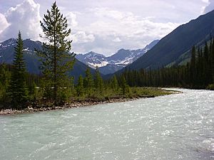
Lead, zinc, copper, and silver are still mined in some places. The huge Sullivan Mine near Kimberley, British Columbia is the largest in the Kootenay watershed. Agriculture is less important now. Many fertile lands along the river were flooded by dams, like Libby Dam. Only about two percent of the Kootenay basin is used for farming. Most of this is for pasture. Crops like oats, barley, and wheat are grown. The main farming area is the Kootenai Valley in northern Idaho.
The West Kootenay region is changing. It's moving from coal mining to tourism. The economy of southeastern British Columbia is relying more on tourism. Several national and provincial parks have been created.
River Changes and Dams
Many dams, power plants, and diversions have been built on the Kootenay River. There are seven dams on the Kootenay. They serve different purposes, from making electricity to controlling the flow of the Columbia River. None of them allow boats or fish to pass through. In the past, the Kootenay River would flood every spring. But now, dams control the water flow.
Dams at the Falls
As early as 1898, the Lower Bonnington Power Plant started making hydroelectricity from Bonnington Falls. This power went to mines in Rossland, British Columbia. The first dam on the river, Upper Bonnington, was meant to help boats pass and fish migrate. But it ended up being built above the falls. When finished in 1906, it only made electricity.
More dams were built at the falls: South Slocan Dam in 1928 and Corra Linn Dam in 1932. These dams created small lakes where the falls used to be. Corra Linn Dam was built to control the level of Kootenay Lake. The Kootenay Canal Generating Station, built in 1976, uses a canal to bypass the old dams. It uses the river's drop in elevation to generate more electricity.
The Lower River
After the falls and the Slocan River join, the last 18 kilometers (11 miles) of the Kootenay flow gradually. In 1944, the Brilliant Dam was built. It's only 2.5 kilometers (1.5 miles) before the Kootenay River flows into the Columbia River at Castlegar.
Columbia River Treaty
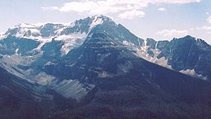
The Columbia Basin is known for its spring floods. Big floods happened in 1876, 1894, 1948, and 1964. In the mid-1960s, the upper Columbia and Kootenay rivers in British Columbia flowed freely. This caused problems like the 1948 Vanport Oregon flood in the U.S.
The Columbia River Treaty was signed in 1961 between Canada and the U.S. It aimed to control floods and generate hydroelectric power. Three dams were built under this treaty: Mica, Keenleyside, and Duncan. The fourth, Libby, was built on the Kootenay River itself. However, these dams have caused environmental problems. They changed water flow, blocked fish, flooded farmland, and forced over 2,000 people to move.
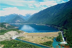
Duncan Dam, built in 1967, only controls water flow into Kootenay Lake. It doesn't make electricity. Libby Dam, completed in 1975, also helps control water flowing into Kootenay Lake. The Kootenay basin's reservoirs store almost half of all the water held in Columbia River Treaty reservoirs.
River Diversion Idea
In the 1970s, there was a plan to divert the Kootenay River into the Columbia River. The two rivers are only about 2 kilometers (1.2 miles) apart near Canal Flats. This would have created more hydroelectric power on the Columbia. It would also have helped reclaim the Kootenay Flats for farming.
However, environmental groups and local people strongly opposed this plan. The economy of southeastern British Columbia relies on tourism. Diverting the Kootenay would make the Columbia River deeper and colder. This would flood communities and hurt tourism. It would also dry up the Kootenay River downstream from Canal Flats. This would cut off water for people and make Libby Dam useless. Because of these concerns, the river diversion was never done.
Fun Things to Do
Many parks and protected areas are in the Kootenay River watershed. In Canada, these include:
- Bugaboo Provincial Park
- Creston Valley Wildlife Management Area
- Gilnockie Provincial Park
- Goat Range Provincial Park
- Kianuko Provincial Park
- Kokanee Glacier Provincial Park
- Kootenay National Park
- Mount Assiniboine Provincial Park
- Purcell Wilderness Conservancy Provincial Park and Protected Area
- St. Mary's Alpine Provincial Park
- Top of the World Provincial Park
- Valhalla Provincial Park
- West Arm Provincial Park
Banff National Park is nearby, and Yoho National Park and Glacier National Park are to the north. In the U.S., there's Kootenai National Forest and Kaniksu National Forest.
Kootenay National Park has over 200 kilometers (124 miles) of hiking trails. You can go cross-country skiing and snowshoeing in winter. Kikomun Creek Provincial Park on Lake Koocanusa has campgrounds and boat launches. The Kootenai River Trail in Montana is about 10 kilometers (6 miles) long. It follows the river from Libby to Kootenai Falls and the famous Swinging Bridge.
Fishing is good in the middle Kootenay River and Kootenay Lake. You can find Westslope cutthroat trout, bull trout, kokanee salmon, rainbow trout, and white sturgeon. Kokanee and rainbows are common in Lake Koocanusa. Kootenai Falls and Libby Dam block fish from moving between different parts of the river. The best time for fishing is from June to November. You can fish from the shore or from boats. The Kootenay is known for its "exceptional" trout fishing.
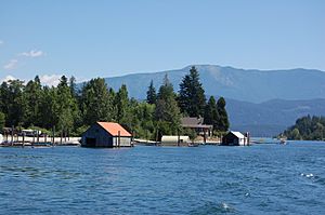
The Kootenay River has steep rapids and is great for whitewater rafting. Rafting is popular in two areas: Jennings Canyon (between Libby Dam and Bonners Ferry) and the upper river in Kootenay National Park. The section in Montana is considered Class I water, meaning it's good for recreation.
Canadian companies offer rafting trips near Kootenay National Park. You can also go canoeing in the marshy areas of the Kootenay Flats. This is a great way to see birds and wildlife. Larger boats like houseboats can travel on Kootenay and Koocanusa Lakes. Rafting and kayaking are also popular on the Slocan River, a major branch of the Kootenay.
See also
 In Spanish: Río Kootenay para niños
 | Sharif Bey |
 | Hale Woodruff |
 | Richmond Barthé |
 | Purvis Young |


