
Image: Aquatic Dead Zones
Size of this preview: 800 × 468 pixels. Other resolutions: 320 × 187 pixels | 3,577 × 2,094 pixels.
Original image (3,577 × 2,094 pixels, file size: 856 KB, MIME type: image/jpeg)
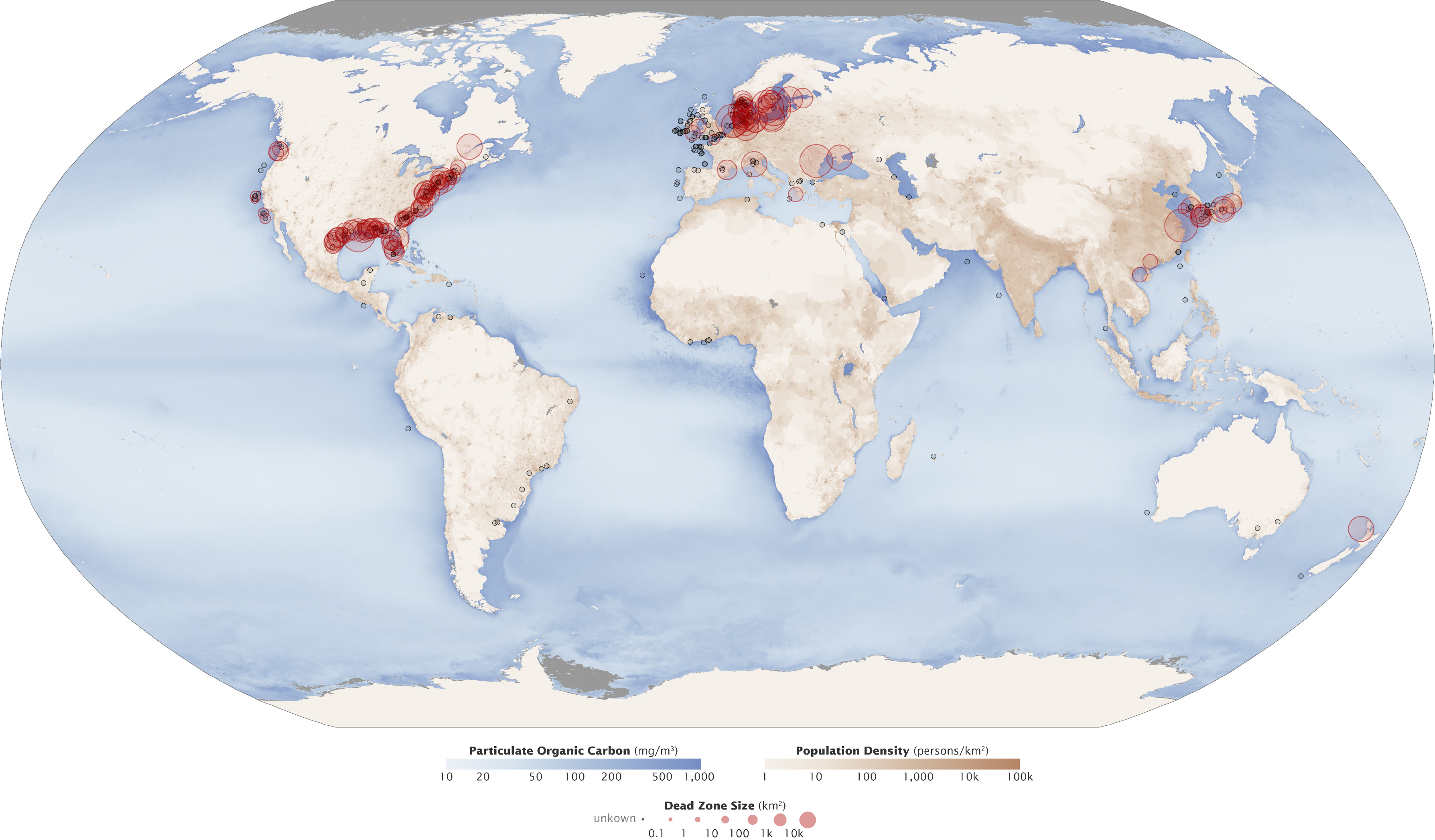
Description: Red circles on this map show the location and size of many of our planet’s dead zones. Black dots show where dead zones have been observed, but their size is unknown. It’s no coincidence that dead zones occur downriver of places where human population density is high (darkest brown). Darker blues in this image show higher concentrations of particulate organic matter, an indication of the overly fertile waters that can culminate in dead zones.
Title: Aquatic Dead Zones
Credit: NASA Earth Observatory
Author: Robert Simmon & Jesse Allen
Usage Terms: Public domain
License: Public domain
Attribution Required?: No
Image usage
The following 3 pages link to this image:

All content from Kiddle encyclopedia articles (including the article images and facts) can be freely used under Attribution-ShareAlike license, unless stated otherwise.