
Image: Arctic Ocean relief location map

Size of this preview: 600 × 600 pixels. Other resolutions: 240 × 240 pixels | 1,181 × 1,181 pixels.
Original image (1,181 × 1,181 pixels, file size: 2.19 MB, MIME type: image/png)
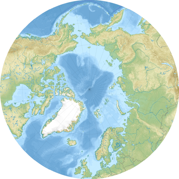
Description: Relief location map of the Arctic Ocean. Projection: Azimuthal equidistant projection. Area of interest: N: 90.0° N S: 50.0° N W: -180.0° E E: 180.0° E Projection center: NS: 90° N WE: 0° E GMT projection: -JE0.0/90.0/20.0c GMT region: -R-45/33.432/135/33.432r GMT region for grdcut: -R-180/180/50/90 Relief: SRTM30plus. Made with Natural Earth. Free vector and raster map data @ naturalearthdata.com.
Title: Arctic Ocean relief location map
Credit: Own work
Author: Uwe Dedering
Usage Terms: Creative Commons Attribution-Share Alike 3.0
License: CC BY-SA 3.0
License Link: https://creativecommons.org/licenses/by-sa/3.0
Attribution Required?: Yes
Image usage
The following 2 pages link to this image:

All content from Kiddle encyclopedia articles (including the article images and facts) can be freely used under Attribution-ShareAlike license, unless stated otherwise.