
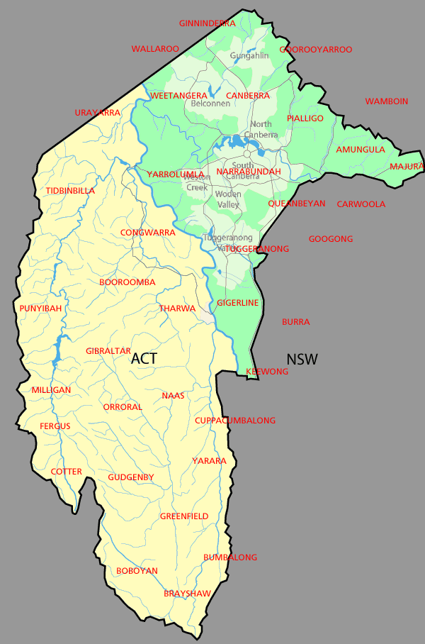
Image: Australian Capital Territory parishes
Description: Parishes (shown in red) in the area of the Australian Capital Territory. The ones wholly within the ACT are former parishes and do not exist anymore. The land in green was part of Murray County, that in yellow part of Cowley County. (Divided by the Murrumbidgee River)
Title: Australian Capital Territory parishes
Credit: Made from Martyman's GFDL map of the ACT here, using information from the National Library of Australia map here (Map showing proposed Federal Capital Territory and tenures of land within same, 1909)
Author: derivative of Martyman's GFDL map
Usage Terms: Creative Commons Attribution-Share Alike 3.0
License: CC-BY-SA-3.0
License Link: http://creativecommons.org/licenses/by-sa/3.0/
Attribution Required?: Yes
Image usage
The following 2 pages link to this image:
