
Image: Austria Carinthia location map

Size of this PNG preview of this SVG file: 800 × 472 pixels. Other resolution: 320 × 189 pixels.
Original image (SVG file, nominally 1,342 × 792 pixels, file size: 932 KB)
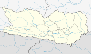
Description: Location map of Carinthia. Equirectangular projection. Geographic limits of the map: N: 47.260053° N S: 46.232250° N W: 12.592633° E E: 15.135427° E
Title: Austria Carinthia location map
Credit: Own work, based on maps-for-free.com and File:Gemeinden Kärnten.svg This W3C-unspecified vector image was created with Inkscape .
Author: Rosso Robot, versions later 2013-10: NordNordWest
Usage Terms: Creative Commons Attribution-Share Alike 3.0
License: CC BY-SA 3.0
License Link: https://creativecommons.org/licenses/by-sa/3.0
Attribution Required?: Yes
Image usage
The following 4 pages link to this image:

All content from Kiddle encyclopedia articles (including the article images and facts) can be freely used under Attribution-ShareAlike license, unless stated otherwise.