
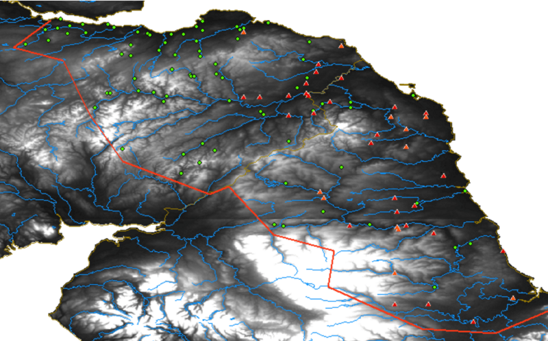
Image: Brittonic and Old English place names in the pre-1974 counties of Northumbria Durham Selkirkshire Roxburghshire Berwickshire Peeblesshire and the Lothians

Description: Map of place-names between the Firth of Forth and the River Tees: in green, names likely containing Brittonic elements; in red and orange, names likely containing the Old English elements -ham and -ingaham respectively. Survey area (approximately marked, in red) covers the pre-1974 counties of Northumbria, Durham, Selkirkshire, Roxburghshire, Berwickshire, Peeblesshire and the Lothians. Higher ground is lighter in colour; rivers are blue. First published at http://www.heroicage.org/issues/10/placenames/frames.htm as part of Bethany Fox, 'The P-Celtic Place-Names of North-East England and South-East Scotland', The Heroic Age, 10 (2007), http://www.heroicage.org/issues/10/fox.html.
Title: Brittonic and Old English place names in the pre-1974 counties of Northumbria Durham Selkirkshire Roxburghshire Berwickshire Peeblesshire and the Lothians
Credit: Own work
Author: Alarichall
Usage Terms: Creative Commons Attribution-Share Alike 4.0
License: CC BY-SA 4.0
License Link: https://creativecommons.org/licenses/by-sa/4.0
Attribution Required?: Yes
Image usage
The following 3 pages link to this image:
