
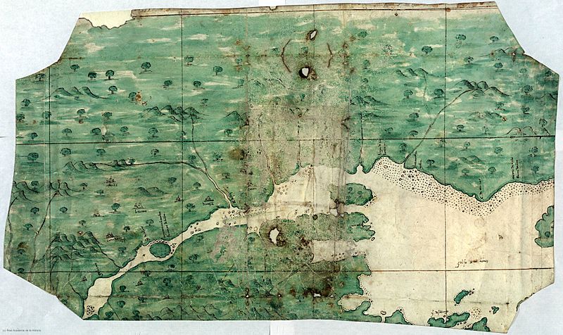
Image: Carte espagnole fleuve Saint Laurent

Size of this preview: 800 × 476 pixels. Other resolutions: 320 × 190 pixels | 4,168 × 2,479 pixels.
Original image (4,168 × 2,479 pixels, file size: 1.68 MB, MIME type: image/jpeg)
Description: Map of the Saint Lawrence river region (in today's Canada) made in Spain in the 16th century, and preserved today at the Real Academia de la Historia.
Title: Carte espagnole fleuve Saint Laurent
Credit: Real Academia de la Historia
Author: Anónimo, siglo XVI, España
Usage Terms: Public domain
License: Public domain
Attribution Required?: No
Image usage
The following 2 pages link to this image:

All content from Kiddle encyclopedia articles (including the article images and facts) can be freely used under Attribution-ShareAlike license, unless stated otherwise.