
Image: Dot map black hispanic
Size of this preview: 800 × 501 pixels. Other resolutions: 320 × 200 pixels | 3,116 × 1,950 pixels.
Original image (3,116 × 1,950 pixels, file size: 1.04 MB, MIME type: image/png)
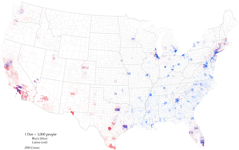
Description: This is a bivariate dot density map, using different colors to visualize the distribution of two populations (2010 census by county). A dasymetric technique has also been applied to exclude points from land known to be uninhabited, primarily public lands in the West.
Author: Bplewe
Usage Terms: Creative Commons Attribution-Share Alike 3.0
License: CC-BY-SA-3.0
License Link: http://creativecommons.org/licenses/by-sa/3.0/
Attribution Required?: Yes
Image usage
The following 2 pages link to this image:

All content from Kiddle encyclopedia articles (including the article images and facts) can be freely used under Attribution-ShareAlike license, unless stated otherwise.