
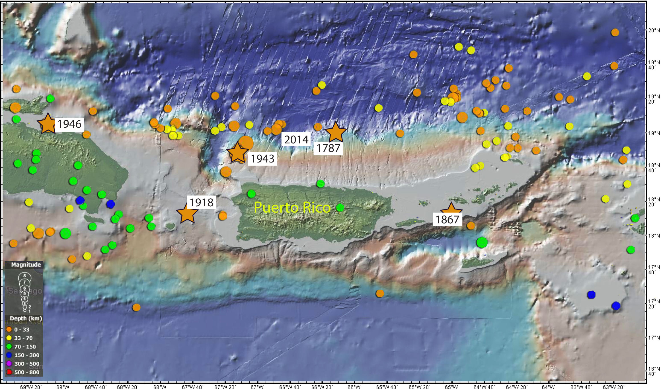
Image: Epicenters of earthquakes around Puerto Rico in last 100 years
Description: Map showing the epicenters of all the magnitude 5 and greater earthquakes around Puerto Rico for the last 100 years. Filled circle colour indicates depth and circle size indicates magnitude. The five biggest, most destructive, earthquakes of the last 250 years with magnitudes of 7 and greater are shown by stars. Bathymetry data generated using the Global Multi-Resolution Topography (GMRT) synthesis in GeoMapApp. Earthquake locations courtesy of the USGS.
Title: Epicenters of earthquakes around Puerto Rico in last 100 years
Credit: https://oceanexplorer.noaa.gov/okeanos/explorations/ex1502/logs/apr27/apr27.html
Author: U.S. Geological Survey
Usage Terms: Public domain
License: Public domain
Attribution Required?: No
Image usage
The following 2 pages link to this image:
