
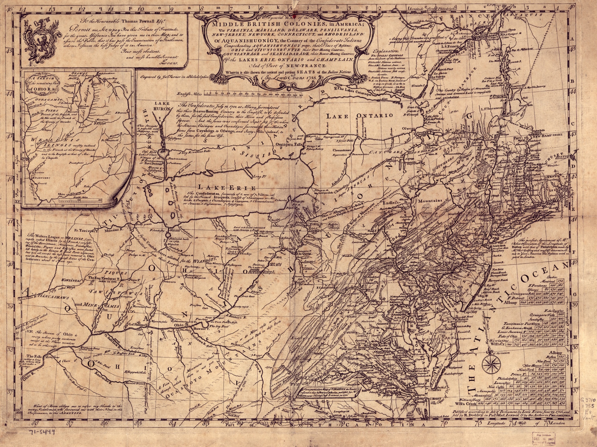
Image: EvansPownallMap1755
Size of this preview: 800 × 600 pixels. Other resolutions: 320 × 240 pixels | 2,048 × 1,535 pixels.
Original image (2,048 × 1,535 pixels, file size: 1.77 MB, MIME type: image/jpeg)
Description: The "Evans-Pownall" map of eastern North America.
Title: EvansPownallMap1755
Credit: This map is available from the United States Library of Congress's Geography & Map Division under the digital ID g3710.ar070900. This tag does not indicate the copyright status of the attached work. A normal copyright tag is still required. See Commons:Licensing for more information.
Author: Lewis Evans (c.1700–1756)
Usage Terms: Public domain
License: Public domain
Attribution Required?: No
Image usage
The following 4 pages link to this image:

All content from Kiddle encyclopedia articles (including the article images and facts) can be freely used under Attribution-ShareAlike license, unless stated otherwise.