
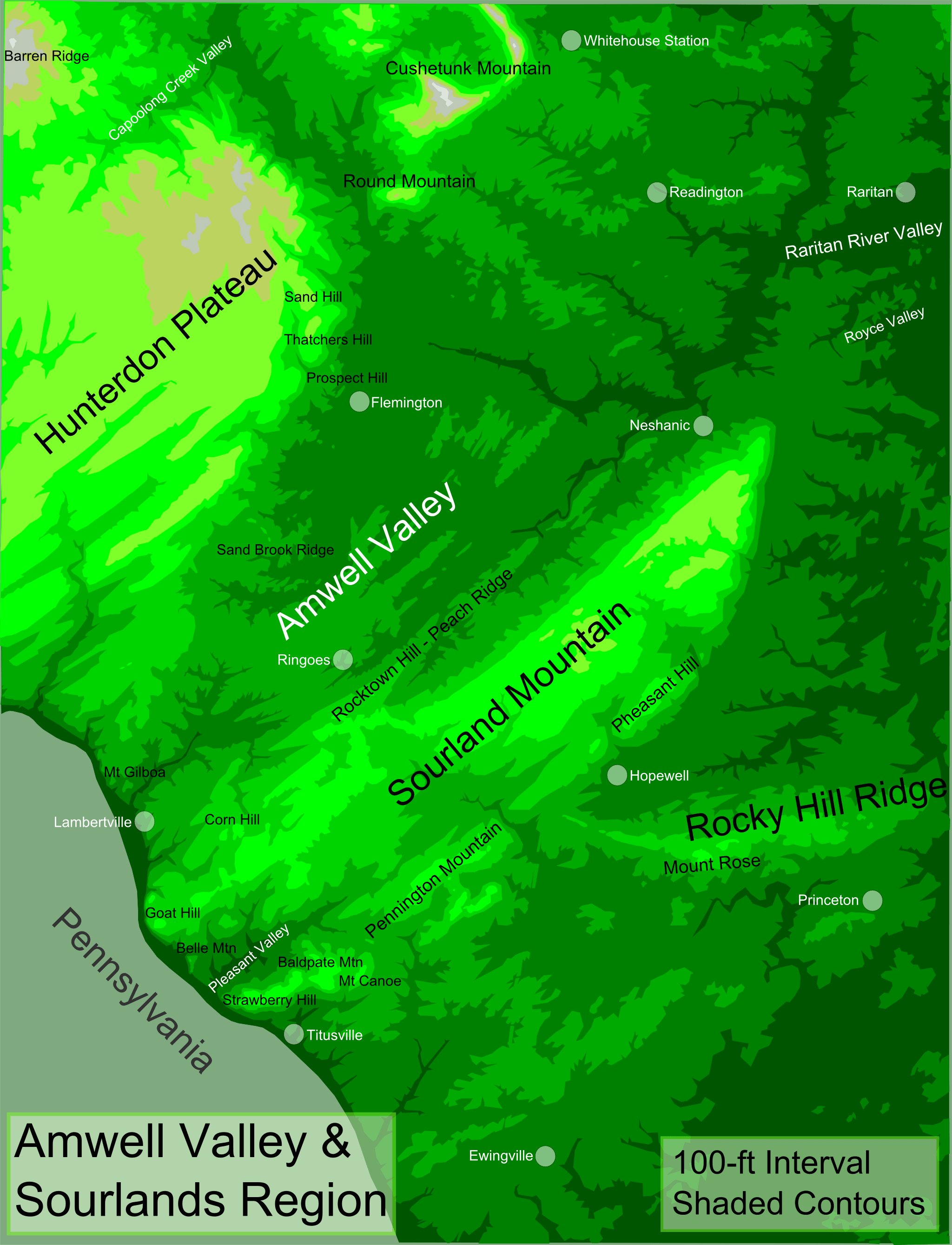
Image: Greater Amwell and Sourland Region
Description: Topographic map of Greater Amwell and The Sourlands Region of New Jersey — featuring the Sourland Mountain ridge. The map uses shaded contours at 100-ft intervals to depict topography. Legend Darkest Green = 0-100 ft Dark Green = 100-200 ft Medium Green = 200-300 ft Light Green = 300-400 ft Lightest Green = 400-500 ft Yellow-Green = 500-600 ft Beige = 600-700 ft Gray = 700-800 ft Light Gray = 800-900 ft White dots = centers of villages/towns. Map is oriented north-up and is ~19.5 miles east to west. Created by tiling nine topographic maps of the Amwell Valley-Sourlands Region and tracing contours at 100-ft intervals.
Title: Greater Amwell and Sourland Region
Credit: Own work
Author: Lithium6ion
Usage Terms: Public domain
License: Public domain
Attribution Required?: No
Image usage
The following 4 pages link to this image:
