
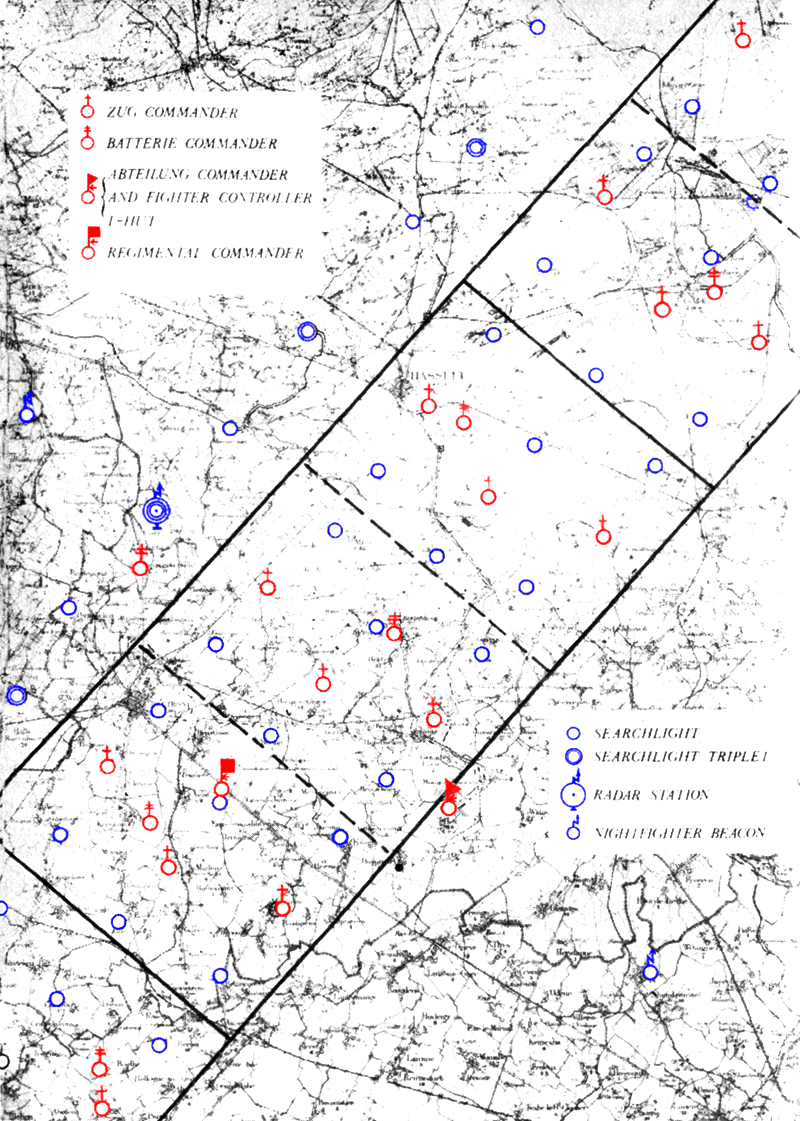
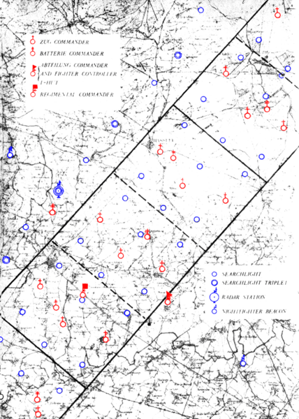
Image: Kammhuber Line Map - Agent Tegal
Size of this preview: 428 × 600 pixels. Other resolutions: 171 × 240 pixels | 800 × 1,121 pixels.
Original image (800 × 1,121 pixels, file size: 958 KB, MIME type: image/png)
Description: A map of the Kammhuber Line stolen by the Belgian Resistance Network Tégal and passed-on to Britain.
The original caption reads: Part of a German map stolen by a Belgian patriot (agent Tegal) 20 April, 1942, showing the entire radar and searchlight dispositions in one box (No. 6B) of the Kammhuber Line. The box of 27 searchlights occupies a front of 30 kilometres.
The map covers the area of Hasselt (Province Limburg Belgium).
Usage Terms: Public domain
Image usage
The following 5 pages link to this image:

All content from Kiddle encyclopedia articles (including the article images and facts) can be freely used under Attribution-ShareAlike license, unless stated otherwise.