
Image: Knoxville Campaign Area 1863

Size of this preview: 693 × 599 pixels. Other resolutions: 278 × 240 pixels | 2,401 × 2,077 pixels.
Original image (2,401 × 2,077 pixels, file size: 2.8 MB, MIME type: image/png)
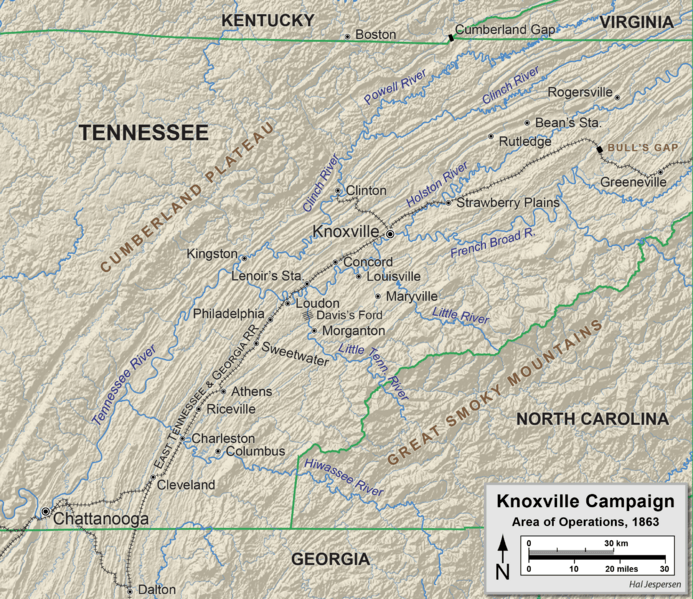
Description: Map of the principal locations in the Knoxville Campaign of 1863. Map drawn by Hal Jespersen and Adobe Illustrator CC. Graphic source file available at http://www.cwmaps.com/freemaps.html
Title: Knoxville Campaign Area 1863
Credit: Own work
Author: Hlj
Usage Terms: Creative Commons Attribution-Share Alike 4.0
License: CC BY-SA 4.0
License Link: https://creativecommons.org/licenses/by-sa/4.0
Attribution Required?: Yes
Image usage
The following 7 pages link to this image:

All content from Kiddle encyclopedia articles (including the article images and facts) can be freely used under Attribution-ShareAlike license, unless stated otherwise.