
Image: Lake bonneville map

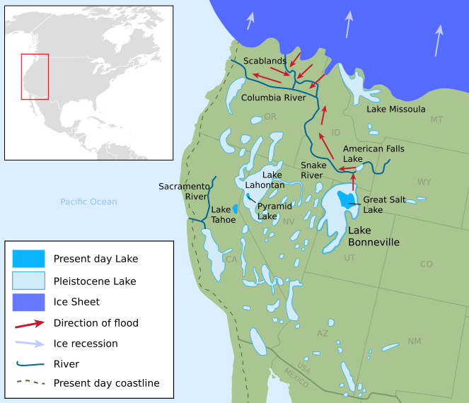
Description: Pleistocene epoch map showing the extent of the Lake Bonneville Flood and Pleistocene lakes in northwestern United States around 14.5000 radiocarbon years (~17,500 calendar years) before present.
Title: Lake bonneville map
Credit: Own work. Based on this map by Laura DeGrey, Myles Miller and Paul Link of Idaho State University, Dept. of Geosciences. Inset North America map from File:America-blank-map-01.svg Lakes in Western Great Basin sourced from USGS, Extent of Pleistocene Lakes in the Western Great Basin by Marith Reheis, 1999. Further sourced from SERC, Carleton College, Reheis and Bright, 2009. Coastline based on The Pacific Northwest Coast: Living With the Shores of Washington and Oregon, Paul D. Komar and USGS map. iThe source code of this SVG is valid.
Author: Fallschirmjäger
Usage Terms: Creative Commons Attribution-Share Alike 3.0
License: CC BY-SA 3.0
License Link: https://creativecommons.org/licenses/by-sa/3.0
Attribution Required?: Yes
Image usage
The following 2 pages link to this image:
