
Image: Manhasset-Bay-NY-1917
No higher resolution available.
Manhasset-Bay-NY-1917.jpg (395 × 477 pixels, file size: 63 KB, MIME type: image/jpeg)
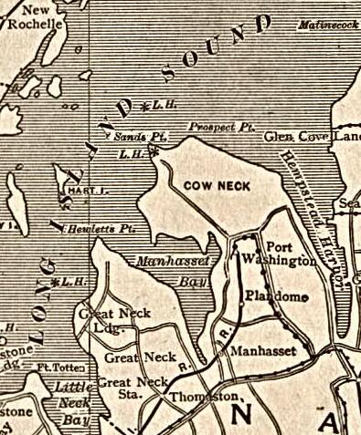
Description: Map of Manhasset Bay, Long Island, New York from a 1917 map of New York City.
Title: Manhasset-Bay-NY-1917
Credit: Map of New York City in The New Encyclopedic Atlas and Gazetteer of the World. New York: P.F. Collier & Son, 1917
Author: P.F. Collier & Son
Permission: public domain
Usage Terms: Public domain
License: Public domain
Attribution Required?: No
Image usage
The following 2 pages link to this image:

All content from Kiddle encyclopedia articles (including the article images and facts) can be freely used under Attribution-ShareAlike license, unless stated otherwise.