
Image: MapSinaiWWI

Size of this preview: 800 × 461 pixels. Other resolutions: 320 × 184 pixels | 1,400 × 806 pixels.
Original image (1,400 × 806 pixels, file size: 276 KB, MIME type: image/jpeg)
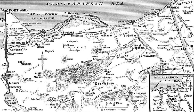
Description: Map of the Northern and Central Sinai area in World War I.
Title: MapSinaiWWI
Credit: "The Times History of the War" Volume X, page 368.
Author: British Government
Usage Terms: Public domain
License: Public domain
Attribution Required?: No
Image usage
The following 4 pages link to this image:

All content from Kiddle encyclopedia articles (including the article images and facts) can be freely used under Attribution-ShareAlike license, unless stated otherwise.