
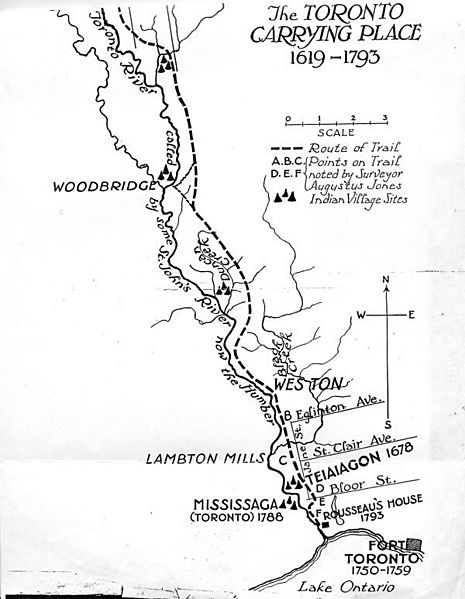
Image: Map of the Lower Humber River and the Toronto Carrying Place trail, showing Native villages

Description: Map of the Lower Humber River and the Toronto Carrying Place trail, showing Native villages.
Title: Map of the Lower Humber River and the Toronto Carrying Place trail, showing Native villages
Credit: https://taiaiakon.wordpress.com/2012/09/19/taiaiaikon/
Author: Charles William Jefferys
Permission: Public domainPublic domainfalsefalse This Canadian work is in the public domain in Canada because its copyright has expired due to one of the following: 1. it was subject to Crown copyright and was first published more than 50 years ago, or it was not subject to Crown copyright, and 2. it is a photograph that was created prior to January 1, 1949, or 3. the creator died more than 50 years ago. العربيَّة | čeština | Deutsch | English | español | suomi | français | italiano | 日本語 | 한국어 | македонски | മലയാളം | Nederlands | português | português do Brasil | sicilianu | +/−
Usage Terms: Public domain
License: Public domain
Attribution Required?: No
Image usage
The following 2 pages link to this image:
