
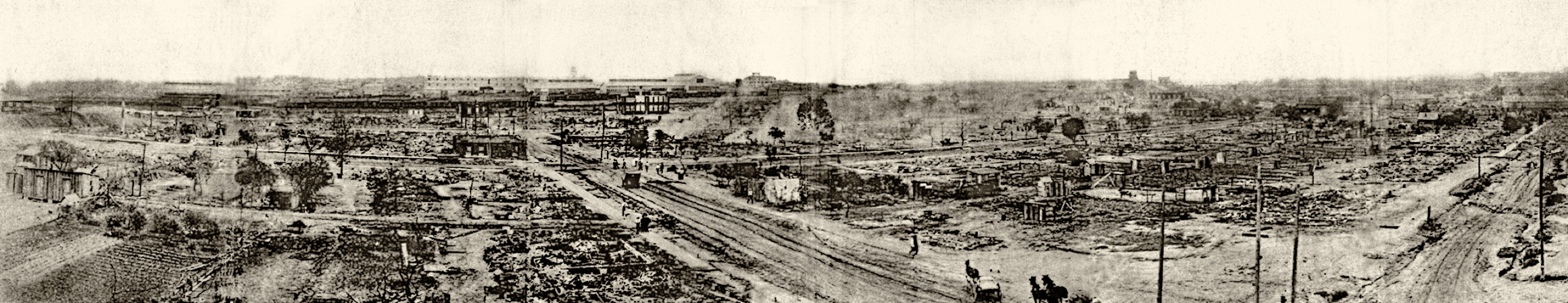
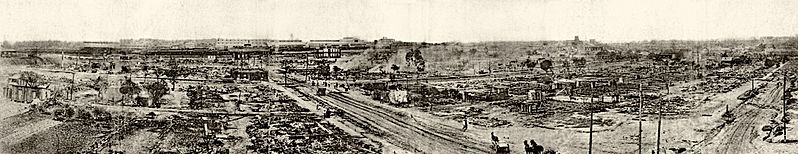
Image: Panorama of the ruined area tulsa race riots (retouched)
Size of this preview: 798 × 154 pixels. Other resolutions: 320 × 62 pixels | 2,320 × 448 pixels.
Original image (2,320 × 448 pixels, file size: 892 KB, MIME type: image/jpeg)
Description: Taken from the southeast corner of the roof of Booker T. Washington High School, this panorama shows much of the damage within a day or so of the riot and the burning. The road running laterally through the center of the image is Greenwood Avenue, the road slanting from the center to the left is Easton, and the road slanting off to the right is Frankfort.
Title: Panorama of the ruined area tulsa race riots (retouched)
Credit: This file was derived from: Panorama of the ruined area tulsa race riots.jpg:
Author: Events of the Tulsa Disaster, Mary E. Jones Parrish
Usage Terms: Public domain
License: Public domain
Attribution Required?: No
Image usage
The following 2 pages link to this image:

All content from Kiddle encyclopedia articles (including the article images and facts) can be freely used under Attribution-ShareAlike license, unless stated otherwise.
.jpg)