
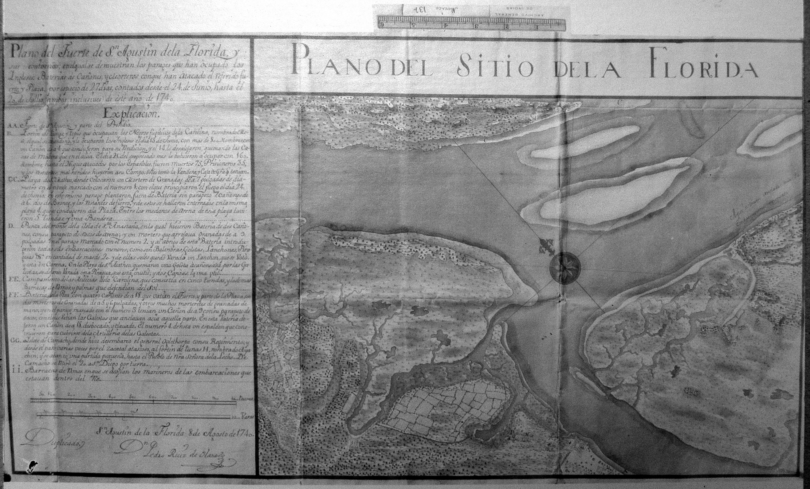
Image: Plano del Sitio de la Florida 1740
Size of this preview: 800 × 483 pixels. Other resolutions: 320 × 193 pixels | 2,636 × 1,592 pixels.
Original image (2,636 × 1,592 pixels, file size: 2.23 MB, MIME type: image/jpeg)
Description: Plan of the fort of Saint Augustine, Florida and its contours: in which are shown the places occupied by the English, Batteries of cannons and mortars with which they have attacked the referred fort and square for 27 days, counted from June 24 to July 20 (both inclusive) of this year of 1740. Saint Augustine, Florida August 8, 1740.
Title: Plano del Sitio de la Florida 1740
Credit: Plano del Sitio de la Florida, Pedro Ruiz de Olano 1740. Original in Archivo General de Indias, Mapas y Planos, Florida-Luisiana 44
Author: Pedro Ruiz de Olano
Usage Terms: Public domain
License: Public domain
Attribution Required?: No
Image usage
The following 2 pages link to this image:

All content from Kiddle encyclopedia articles (including the article images and facts) can be freely used under Attribution-ShareAlike license, unless stated otherwise.