
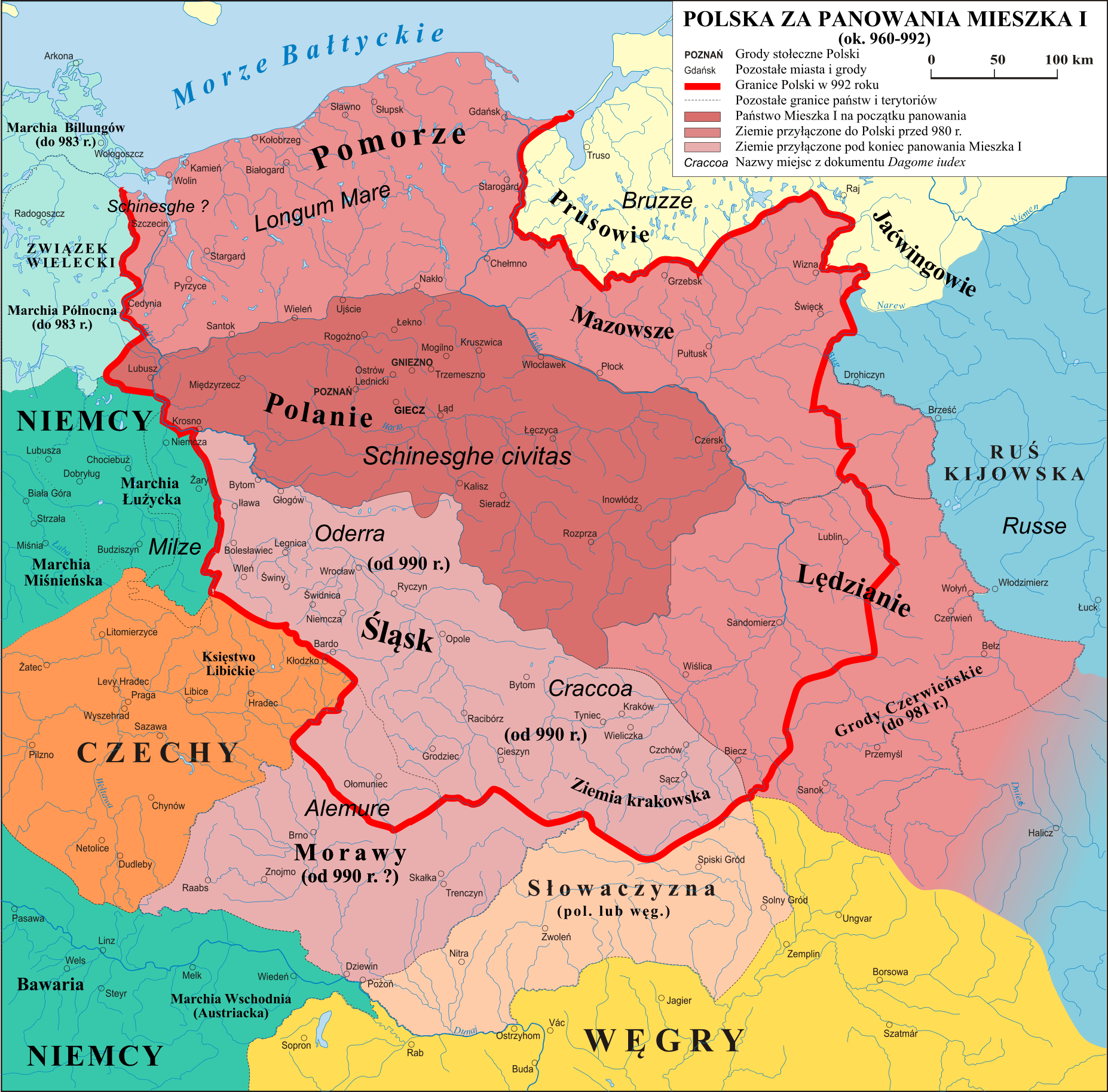
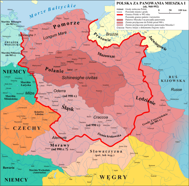
Image: Polska 960 - 992
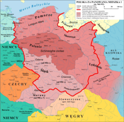
Size of this preview: 608 × 599 pixels. Other resolutions: 243 × 240 pixels | 1,854 × 1,828 pixels.
Original image (1,854 × 1,828 pixels, file size: 1.45 MB, MIME type: image/png)
Description: Mapa Polski za panowania Mieszka I (ok. 960 - 992)
Title: Polska 960 - 992
Credit: własna praca na podstawie: "Ilustrowany Atlas Historii Polski" i publikacji o badaniach na Ostrowie Tumskim w Poznaniu.
Author: Poznaniak
Permission: I, the copyright holder of this work, hereby publish it under the following license:
Usage Terms: Creative Commons Attribution-Share Alike 3.0
License: CC BY-SA 3.0
License Link: https://creativecommons.org/licenses/by-sa/3.0
Attribution Required?: Yes
Image usage
The following 5 pages link to this image:

All content from Kiddle encyclopedia articles (including the article images and facts) can be freely used under Attribution-ShareAlike license, unless stated otherwise.