
Image: PortNewYorkNewJersey
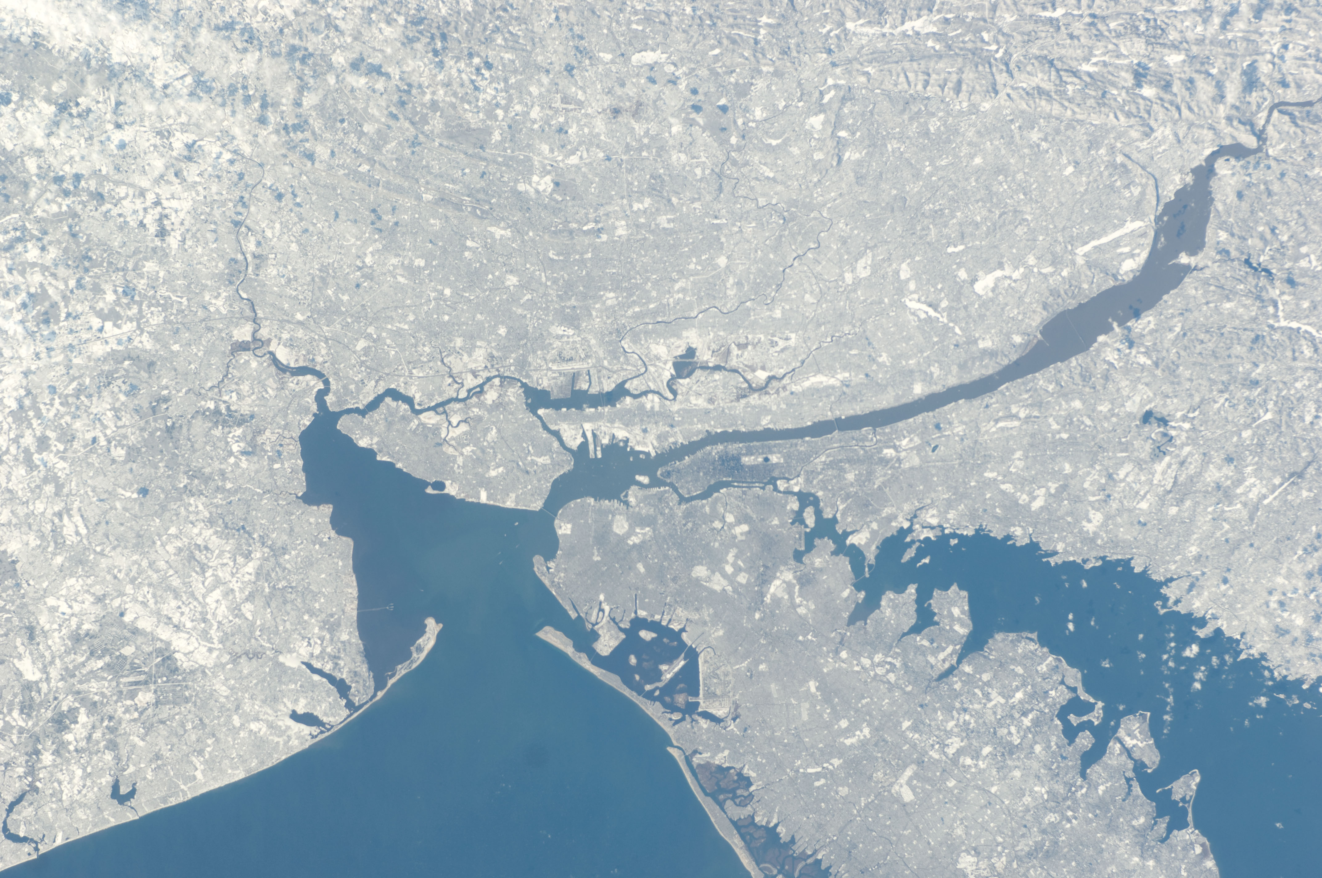
Description: Port of New York and New Jersey from International Space Station January 2011. The Atlantic Ocean is to the southeast of the port. The sea at the entrance to the port is called the New York Bight; it lies between the peninsulas of Sandy Hook and Rockaway. The Lower New York Bay and its western arm, the Raritan Bay, lead to Arthur Kill or Raritan River or to the north to The Narrows To the east lies the Rockaway Inlet, which leads to Jamaica Bay. The Narrows connects to the Upper New York Bay at the mouth of the Hudson River, which is sometimes called the North River. To the west lies Kill van Kull, the strait leading to Newark Bay, fed by the Passaic River and Hackensack River, and the northern entrance of Arthur Kill. The Gowanus Canal and Buttermilk Channel are east of Governors Island. The East River is a broad strait that travels north to Newtown Creek and the Harlem River, turning east at Hell Gate before opening to Long Island Sound, which provides an outlet to the open sea.
Title: PortNewYorkNewJersey
Credit: http://spaceflight.nasa.gov/gallery/images/station/crew-26/html/iss026e017046.html https://www.flickr.com/photos/nasamarshall/5367614894/
Author: NASA
Usage Terms: Public domain
License: Public domain
Attribution Required?: No
Image usage
The following 2 pages link to this image:
