
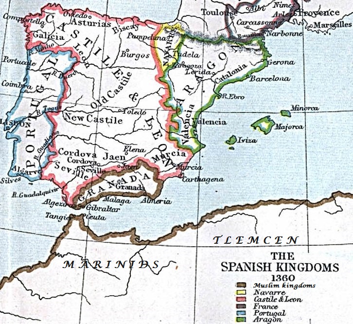
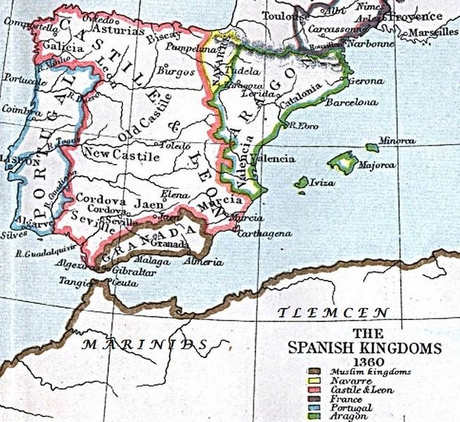
Image: Spain and Western North Africa 1360
Size of this preview: 654 × 600 pixels. Other resolutions: 262 × 240 pixels | 726 × 666 pixels.
Original image (726 × 666 pixels, file size: 249 KB, MIME type: image/jpeg)
Description: A map of Spain and Western North Africa circa 1360. Spanish kingdoms, cities and borders are well-annotated but not the North African ones.
Title: Spain and Western North Africa 1360
Credit: Modified from: http://www.lib.utexas.edu/maps/historical/spanish_kingdoms.html The Atlas To Freeman's Historical Geography, Edited by J.B. Bury, Longmans Green and Co. Third Edition 1903 (see Spanish Kingdoms 1360 A.D.)
Author: Original: The Atlas To Freeman's Historical Geography, Edited by J.B. Bury, Longmans Green and Co. Third Edition 1903 (public domain) Extra annotation by HaEr48
Usage Terms: Public domain
License: Public domain
Attribution Required?: No
Image usage
The following 12 pages link to this image:

All content from Kiddle encyclopedia articles (including the article images and facts) can be freely used under Attribution-ShareAlike license, unless stated otherwise.