
Image: Topography of Kerala
Size of this preview: 404 × 600 pixels. Other resolutions: 161 × 240 pixels | 468 × 695 pixels.
Original image (468 × 695 pixels, file size: 117 KB, MIME type: image/png)
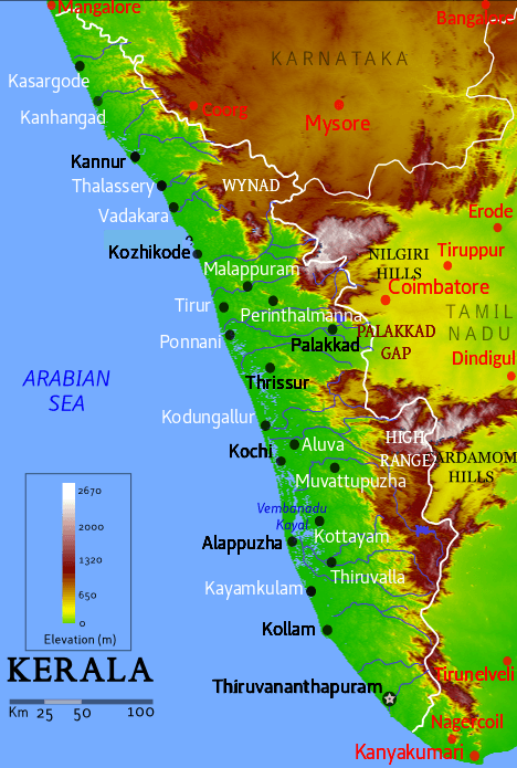
Description: Topographic map for Kerala state, depicting elevation, hills, cities, and major water bodies
Title: Topography of Kerala
Credit: https://upload.wikimedia.org/wikipedia/commons/b/bf/Kerala_geographic_map.png
Author: Mkeranat
Usage Terms: Creative Commons Attribution 3.0
License: CC BY 3.0
License Link: https://creativecommons.org/licenses/by/3.0
Attribution Required?: Yes
Image usage
The following 2 pages link to this image:

All content from Kiddle encyclopedia articles (including the article images and facts) can be freely used under Attribution-ShareAlike license, unless stated otherwise.