
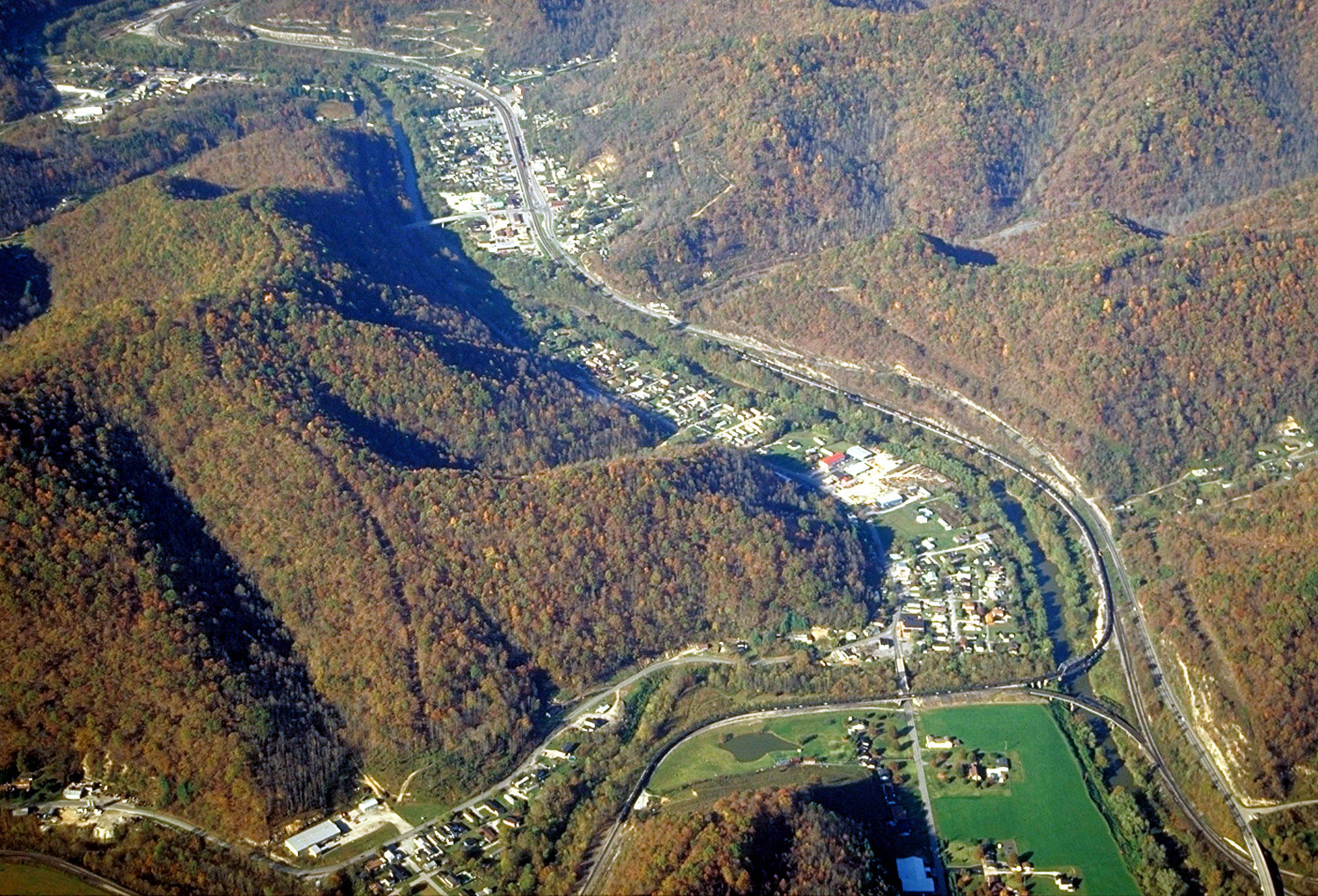
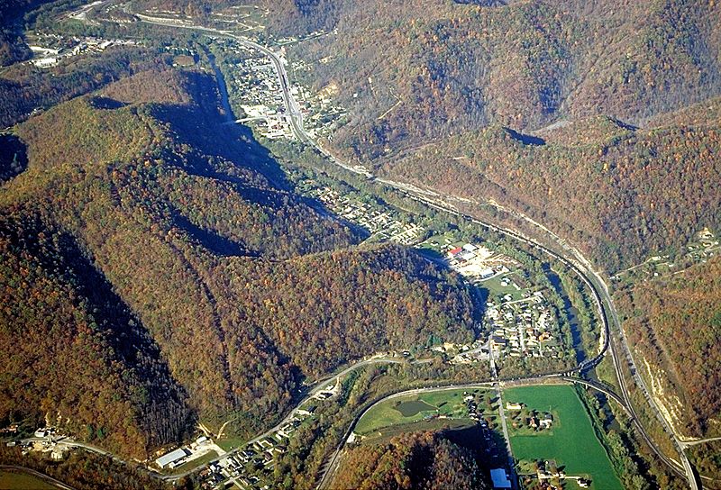
Image: Tug Fork towns aerial view
Description: Communities along the Tug Fork River in Kentucky and West Virginia, USA. The Tug Fork is the state boundary between Kentucky and West Virginia here. The view is northward along the river. The community of Lovely, Martin County, Kentucky is in the foreground on the left of the river. Upriver to the right lies the community of Kermit, West Virginia, in Mingo County. In the upper-left corner of the picture is the town of Warfield, Kentucky. In the 1990s the U.S. Army Corps of Engineers constructed levees and floodwalls to protect the towns from flooding on the Tug Fork. Note that this picture is flipped left-to-right from the source photograph. After studying the source photo on the USACE website and satellite images of the area, it was determined that the original photograph has been erroneously flipped.
Title: Tug Fork towns aerial view
Credit: U.S. Army Corps of Engineers Digital Visual Library Image page Image description page Digital Visual Library home page
Author: U.S. Army Corps of Engineers, photographer not specified or unknown
Permission: This image or file is a work of a U.S. Army Corps of Engineers soldier or employee, taken or made as part of that person's official duties. As a work of the U.S. federal government, the image is in the public domain. English | italiano | Nederlands | русский | Türkçe | українська | +/−
Usage Terms: Public domain
License: Public domain
Attribution Required?: No
Image usage
The following 2 pages link to this image:
