
Image: U.S. Presidential election margin, 2004-2016
Size of this preview: 800 × 542 pixels. Other resolutions: 320 × 217 pixels | 3,169 × 2,146 pixels.
Original image (3,169 × 2,146 pixels, file size: 1.07 MB, MIME type: image/png)
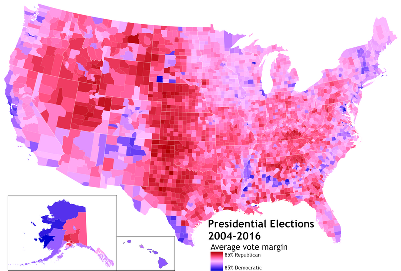
Description: This map aggregates the U.S. presidential elections of 2004, 2008, 2012, and 2016 to show the general political tendencies of each county. Data obtained from MIT Elections Lab.
Author: Bplewe
Usage Terms: Creative Commons Attribution-Share Alike 3.0
License: CC-BY-SA-3.0
License Link: http://creativecommons.org/licenses/by-sa/3.0/
Attribution Required?: Yes
Image usage
The following 2 pages link to this image:

All content from Kiddle encyclopedia articles (including the article images and facts) can be freely used under Attribution-ShareAlike license, unless stated otherwise.