
Image: USA Mass Cape Cod upper lower

Size of this PNG preview of this SVG file: 560 × 420 pixels. Other resolution: 320 × 240 pixels.
Original image (SVG file, nominally 560 × 420 pixels, file size: 264 KB)
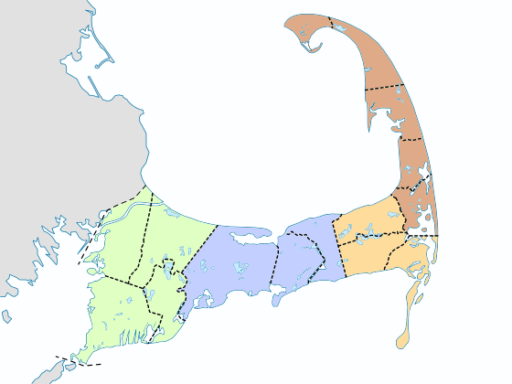
Description: A map of Cape Cod, showing the individual towns grouped by color into their respective "sub-regions": Upper Cape Mid-Cape Lower Cape Outer Cape (historically included in the "Lower Cape").
Title: USA Mass Cape Cod upper lower
Credit: Own work
Author: Grolltech
Usage Terms: Creative Commons Attribution-Share Alike 3.0
License: CC BY-SA 3.0
License Link: https://creativecommons.org/licenses/by-sa/3.0
Attribution Required?: Yes
Image usage
The following 3 pages link to this image:

All content from Kiddle encyclopedia articles (including the article images and facts) can be freely used under Attribution-ShareAlike license, unless stated otherwise.