
Image: USGS Map of Santa Rita and Patagonia Mts 1910
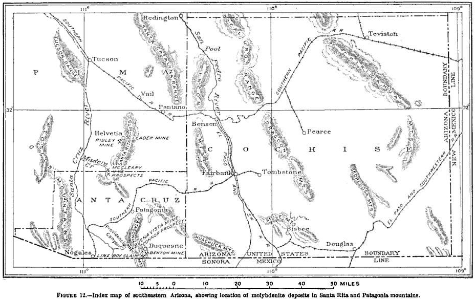
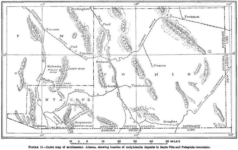
Description: Index map of southeastern Arizona, showing location of molybdenite deposits in Santa Rita and Patagonia Moutains.
Title: USGS Map of Santa Rita and Patagonia Mts 1910
Credit: Bulletin - United States Geological Survey, Issue 430, page 155
Author: USGS
Permission: This image is in the public domain in the United States because it only contains materials that originally came from the United States Geological Survey, an agency of the United States Department of the Interior. For more information, see the official USGS copyright policy. Български | Català | Čeština | Deutsch | English | Español | Eesti | فارسی | Suomi | Français | Galego | Italiano | 日本語 | 한국어 | Македонски | മലയാളം | Nederlands | Polski | Português | Русский | Sicilianu | Türkçe | 中文 | 中文(简体) | +/−
Usage Terms: Public domain
License: Public domain
Attribution Required?: No
Image usage
The following 4 pages link to this image:
