
Image: Ungava Bay map
No higher resolution available.
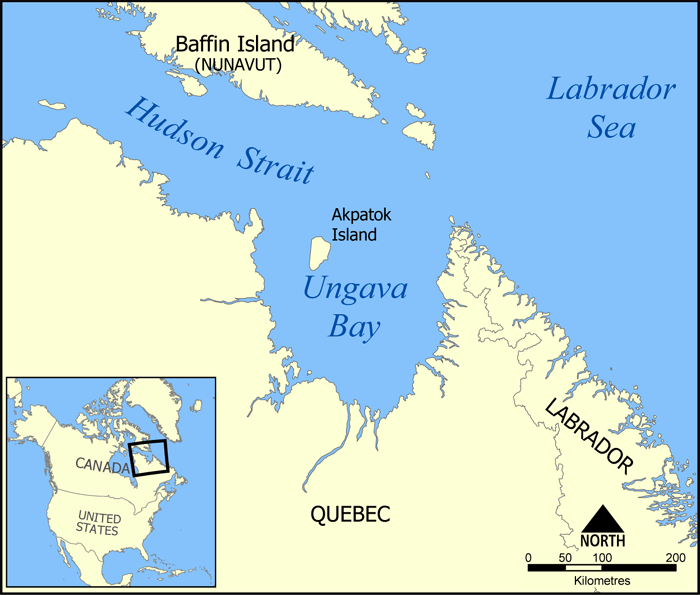
Ungava_Bay_map.png (700 × 595 pixels, file size: 222 KB, MIME type: image/png)
Description: Map showing the location of Ungava Bay, including part of the Hudson Strait and Akpatok Island. Created by NormanEinstein, June 8, 2005.
Title: Ungava Bay map
Credit: No machine-readable source provided. Own work assumed (based on copyright claims).
Author: No machine-readable author provided. NormanEinstein assumed (based on copyright claims).
Usage Terms: Creative Commons Attribution-Share Alike 3.0
License: CC-BY-SA-3.0
License Link: http://creativecommons.org/licenses/by-sa/3.0/
Attribution Required?: Yes
Image usage
The following 2 pages link to this image:

All content from Kiddle encyclopedia articles (including the article images and facts) can be freely used under Attribution-ShareAlike license, unless stated otherwise.