
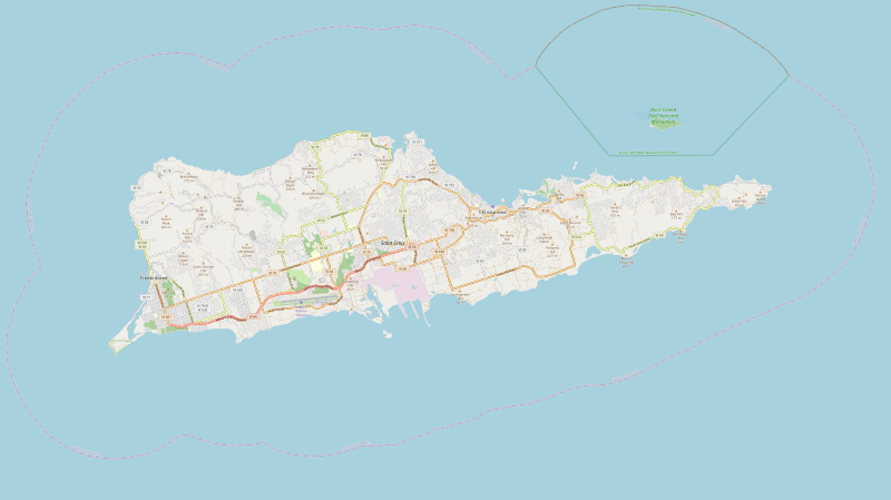
Image: United States Virgin Islands Saint Croix location map

Size of this PNG preview of this SVG file: 800 × 449 pixels. Other resolution: 320 × 180 pixels.
Original image (SVG file, nominally 3,331 × 1,871 pixels, file size: 9.49 MB)
Description: United States Virgin Islands Saint Croix location map with boundries of top=17.7964, left=-64.9182, right=-64.5502, bottom=17.6659
Title: United States Virgin Islands Saint Croix location map
Credit: https://www.openstreetmap.org/export#map=12/17.7240/-64.7222&layers=H
Author: OpenStreetMap contributors
Usage Terms: Creative Commons Attribution-Share Alike 2.0
License: CC BY-SA 2.0
License Link: https://creativecommons.org/licenses/by-sa/2.0
Attribution Required?: Yes
Image usage
The following 6 pages link to this image:

All content from Kiddle encyclopedia articles (including the article images and facts) can be freely used under Attribution-ShareAlike license, unless stated otherwise.