
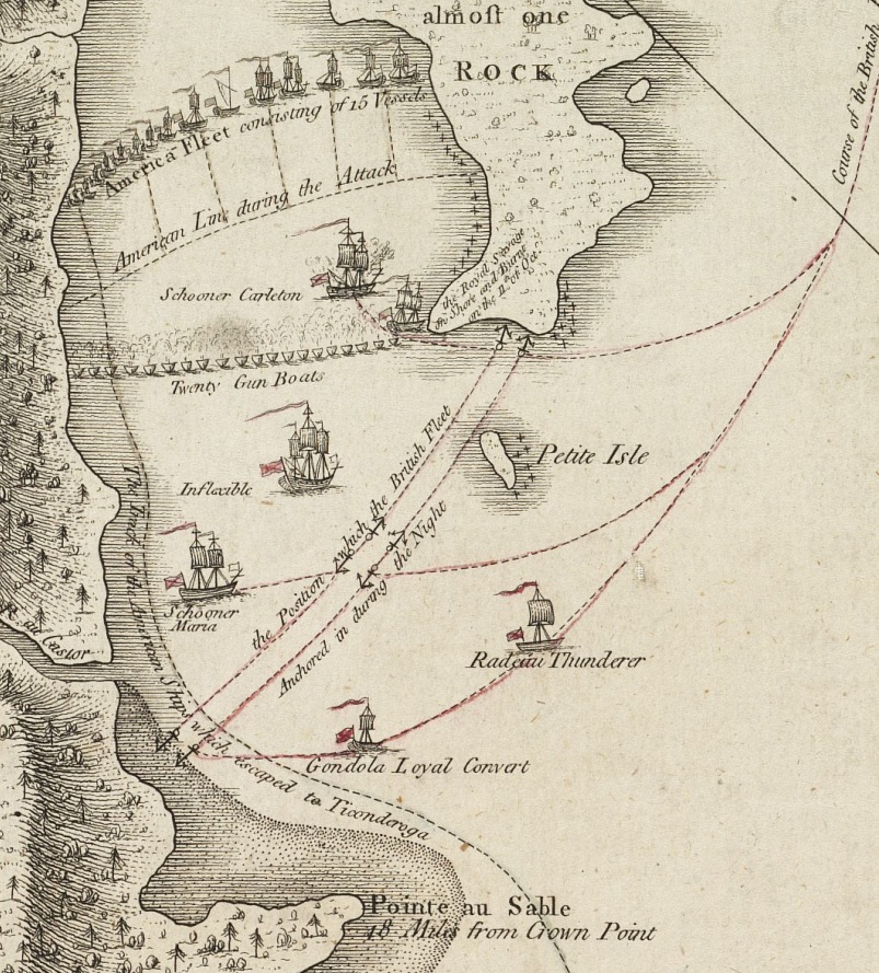
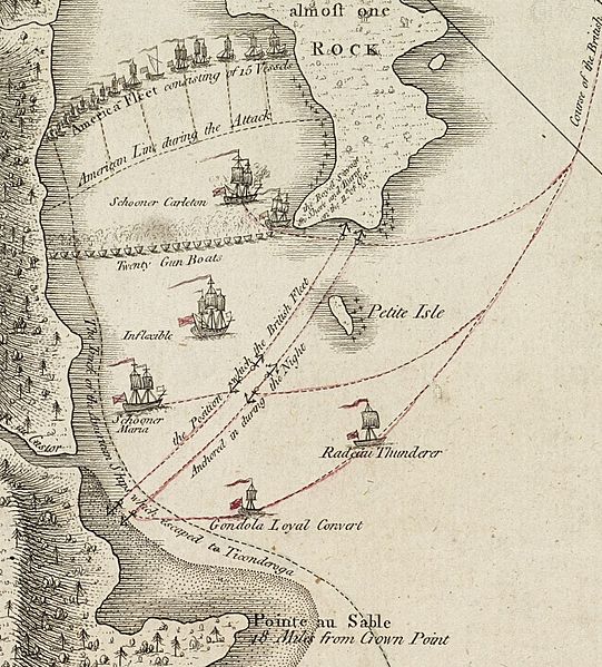
Image: ValcourIslandMap1776Detail
Size of this preview: 541 × 599 pixels. Other resolutions: 217 × 240 pixels | 803 × 889 pixels.
Original image (803 × 889 pixels, file size: 337 KB, MIME type: image/jpeg)
Description: source map showing area detailed in this image This is a blowup of the area highlighted in the map shown to the right, showing the detail of the action in the Battle of Valcour Island.
Title: ValcourIslandMap1776Detail
Credit: From the Boston Public Library Digital Maps Collection (http://maps.bpl.org/). Call number: G3802.C45S3 1776 .F3 URL at time of upload: http://maps.bpl.org/details_10856/
Author: William Faden
Usage Terms: Public domain
License: Public domain
Attribution Required?: No
Image usage
The following 5 pages link to this image:

All content from Kiddle encyclopedia articles (including the article images and facts) can be freely used under Attribution-ShareAlike license, unless stated otherwise.