
National Register of Historic Places listings in Essex County, New York facts for kids

This page is a list of amazing and important places in Essex County, New York, that are part of the National Register of Historic Places. Think of it like a special list of buildings, areas, and sites that are really important to American history and culture. When a place is on this list, it means it's worth protecting and remembering for future generations.
Some of these places are even more special and are called National Historic Landmarks. These are the very best examples of historic places in the whole country!
Contents
Cool Historic Places in Essex County
Essex County is full of fascinating spots, from huge natural parks to old forts and unique houses. Let's explore some of them!
Nature and Big Parks
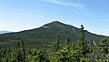
Adirondack Forest Preserve
The Adirondack Forest Preserve is a massive park that covers six million acres, which is about 24,000 square kilometers! All of Essex County is actually inside this huge park. It's a special place for nature and outdoor adventures.
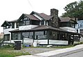
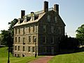
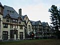
Ausable Club
The Ausable Club is an old clubhouse from 1890. It belongs to the Adirondack Mountain Reserve, which was created to protect a huge area of the Adirondack High Peaks from being cut down for lumber. Even today, the Reserve owns a lot of land and lets people use trails to explore the high peaks.
Camp Santanoni
Camp Santanoni is a huge, beautiful property that's like a fancy old summer camp. It was built between 1892 and 1905 by a banker named Robert C. Pruyn. It's a great example of an "Adirondack Great Camp," which were large, rustic estates built by wealthy families in the Adirondacks.
Old Forts and Battles
Essex County has a rich history, especially with old forts that played a big part in early American conflicts.
Fort Crown Point
Fort Crown Point was built by the British in 1759. They wanted to control this area against the French. Imagine soldiers from long ago, protecting their land right here!
Fort St. Frederic
Before the British, the French started building Fort St. Frederic in 1734. Their goal was to control the border region between New France (now Canada) and what would become Vermont, in the Lake Champlain Valley. This fort was super strong, with walls that were twelve feet thick and four stories high! It had cannons on every level and over a thousand soldiers.
Fort Ticonderoga
Fort Ticonderoga is a famous fort built by the French starting in 1755. It was very important because it controlled two main trade routes between the English-controlled Hudson River Valley and the French-controlled Saint Lawrence River Valley. This fort also played a big role in the American Revolutionary War.
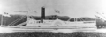
USS Spitfire (Gunboat)
Deep under the waters of Lake Champlain, near Schuyler Island, lies the shipwreck of the USS Spitfire. This was a gunboat from 1776, used during the American Revolutionary War. It's a cool underwater piece of history!
Unique Buildings and Homes
Many buildings in Essex County tell stories about how people lived and worked long ago.
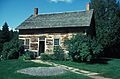
Adsit Log House
The Adsit Log House is one of the oldest log cabins in the United States that is still standing in its original spot! It was built by a veteran of the American Revolutionary War. Imagine living in a house built so long ago!
Adirondack Iron and Steel Company
The Adirondack Iron and Steel Company has the remains of an old iron factory, called "Upper Works," that dates back to 1826. It was a tough business because the iron found there had titanium in it, which made it hard to work with. Plus, it was very isolated.
John Brown Farm and Gravesite
This is the home and final resting place of John Brown, a famous abolitionist. He lived here from 1849. Abolitionists were people who worked to end slavery in the United States.
"Cure Cottages" of Saranac Lake
Many places in Saranac Lake are called "cure cottages." These were special houses where people with tuberculosis (a lung disease) would come to rest and get better in the fresh mountain air. Many of these cottages were designed with special "cure porches" where patients could relax outdoors.
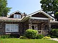
- Bogie Cottage: A "cure cottage" from 1908, built in the American Craftsman style.
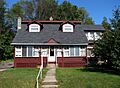
- Peyton Clark Cottage: A large, Tudor-style "cure cottage" from 1915, designed by William H. Scopes. The owner was an engineer whose wife had tuberculosis.
- Coulter Cottage: A "cure cottage" built between 1897 and 1899, designed by William L. Coulter as his own home.
- Denny Cottage: Another "cure cottage" built around 1910.
- Fallon Cottage Annex: A "cure cottage" from 1901.
- Helen Hill Historic District: This neighborhood has many cottages with "cure porches," showing how important the area was for healing.
- Highland Park Historic District: This area has seventeen private homes built between 1896 and 1930, most with "cure cottage" features.
- Hill Cottage: A Craftsman-style "cure cottage" from 1913.
- Kennedy Cottage: A "cure cottage" from 1987 that was used by a group helping vaudeville performers.
- Lane Cottage: A "cure cottage" from 1923, built by Edward Shaw for his wife, who had tuberculosis. They even built a separate house nearby for their children to keep them safe from the illness.
- Dr. Henry Leetch House: A "cure cottage" from 1932, designed by William L. Distin for Dr. Henry Leetch, who specialized in treating tuberculosis and had the disease himself.
- Lent Cottage: An apartment house built around 1920 that was also used as a "cure cottage."
- Marquay Cottage: A Queen Anne-style "cure cottage" from 1914, made of cool cast-concrete blocks with an octagonal tower.
- Marvin Cottage: A "cure cottage" built around 1900.
- Partridge Cottage: A Colonial Revival apartment house from 1925, with three apartments used as "cure cottages" for different families.
- Pittenger Cottage: A "cure cottage" with five cure porches, built around 1920.
- Stevenson Cottage: A "cure cottage" used by the famous writer Robert Louis Stevenson in 1887.
- Stuckman Cottage: A "cure cottage" built between 1897 and 1900.
- Trudeau Sanatorium: This was a hospital for tuberculosis patients, started in 1882 by Dr. Edward Livingston Trudeau. It was originally called the Adirondack Cottage Sanatorium.
- Will Rogers Memorial Hospital: A 100-bed tuberculosis hospital built in 1930 especially for vaudeville performers.
Other Interesting Places
Essex County Municipal Complex
The Essex County Municipal Complex includes the county courthouse, which was built in 1824. It's the main building for the county government.
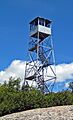
Hurricane Mountain Fire Observation Station
This is a 35-foot (about 11-meter) fire tower built in 1919 on top of Hurricane Mountain, which is 3,964 feet (about 1,208 meters) high. Fire towers like this helped spot forest fires from far away.
Poke-O-Moonshine Mountain Fire Observation Station
This fire tower from 1917 was the first in New York State to use a special tool called an alidade to help figure out exactly where fires were located.
Mount Van Hoevenberg Olympic Bobsled Run
This is a famous bobsled run in Lake Placid, where Olympic athletes have competed!
New York Central Railroad Adirondack Division Historic District
This district includes parts of the old New York Central Railroad line that ended in Lake Placid. You can still see old train stations in places like Ray Brook and Lake Placid. A tourist train still runs on part of this historic line.
Octagonal Schoolhouse
In Essex, there's an unusual stone school building from 1827 that is shaped like an octagon (an eight-sided shape)!
Whiteface Veterans Memorial Highway Complex
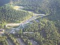
This is the highest road in New York State, built in the late 1920s to honor veterans of World War I. It offers amazing views!
Images for kids
-
Adirondack Iron and Steel, 1854 Blast Furnace.JPG
The old blast furnace at Adirondack Iron and Steel Company.
-
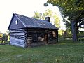
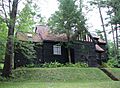
The historic Adsit Log House.
-
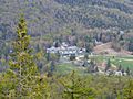
The Ausable Club clubhouse.
-
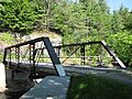
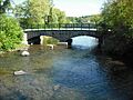
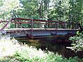
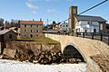
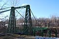
Beer's Bridge over the Ausable River.
-
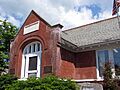
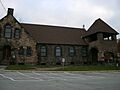
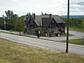
The Black Watch Library.
-
Bogie Cottage, a "cure cottage."
-
The John Brown Farm and Gravesite.
-
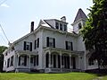
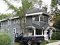
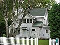
The H. G. Burleigh House.
-
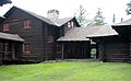
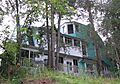
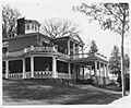
The main lodge at Camp Santanoni.
-
The site of the former Central Powerhouse.
-
The Champlain II Shipwreck.
-
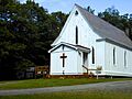
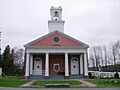
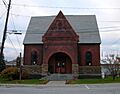
Foothills Baptist Church.
-
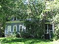
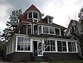
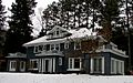
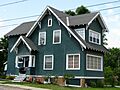
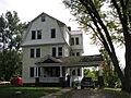
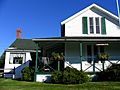
The Clark House.
-
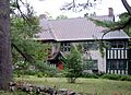
The Peyton Clark Cottage.
-
The Community Building in Ticonderoga.
-
Coulter Cottage.
-
The Clayton H. Delano House.
-
First Congregational Church in Crown Point.
-
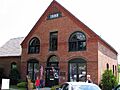
The Delaware & Hudson Railroad Depot.
-
Denny Cottage.
-
The Double-Span Metal Pratt Truss Bridge.
-
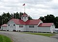
Floral Hall at the Essex County Fairgrounds.
-
The Essex County Home and Farm.
-
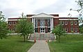
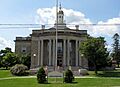
The Essex County Courthouse.
-
Fallon Cottage Annex.
-
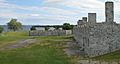
Fort Crown Point.
-
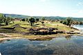
Fort St. Frederic.
-
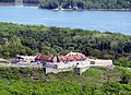
Fort Ticonderoga.
-
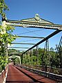
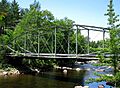
Frazier Bridge.
-
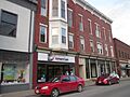
The Gilligan and Stevens Block.
-
The Hancock House.
-

The Hand House.
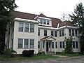
-
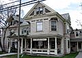
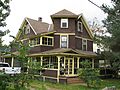
The Christy Mathewson Cottage in Highland Park Historic District.
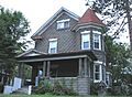
-
Hill Cottage.
-
Hubbard Hall.
-
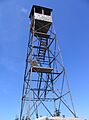
The Hurricane Mountain fire tower.
-
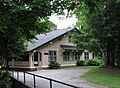
Keene Valley Library.
-
The Richard Keese III House in Keeseville.
-
Kennedy Cottage.
-
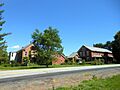
Mill Management Housing in Ticonderoga.
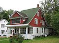
-
Lane Cottage.
-
Dr. Henry Leetch House.
-
Lent Cottage.
-
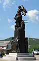
The Liberty Monument.
-
Marquay Cottage.
-
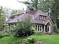
Marvin Cottage.
-

Moriah Town Office Building.
-
Mount Moriah Presbyterian Church.
-
The Mount Van Hoevenberg Olympic Bobsled Run.
-
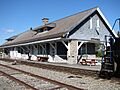
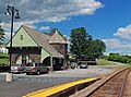
The New York Central Railroad Station in Lake Placid.
-

Notman Bridge.
-
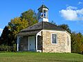
The Octagonal Schoolhouse.
-
Partridge Cottage.
-
Pittenger Cottage.
-
The Poke-O-Moonshine Mountain fire tower.
-
Ranney Bridge.
-
The Sherman Free Library.
-
Stevenson Cottage.
-
The Stone Arch Bridge in Keeseville.
-
Stuckman Cottage.
-
The Swing Bridge in Keeseville.
-
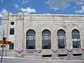
Ticonderoga National Bank.
-
The Ticonderoga Pulp and Paper Company Office.
-
The Gatehouse at the Trudeau Sanatorium.
-
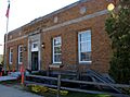
The US Post Office in Lake Placid.
-
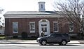
The US Post Office in Ticonderoga.
-
Walton Bridge.
-
The Elkanah Watson House.
-
Whiteface Veterans Memorial Highway.
-
The Will Rogers Memorial Hospital.
-

The Willsboro Congregational Church.
-
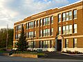
The Willsboro School.
-
Witherbee Memorial Hall.


,_NY.JPG)


.jpg)


.JPG)


