
Image: Vinland Map HiRes
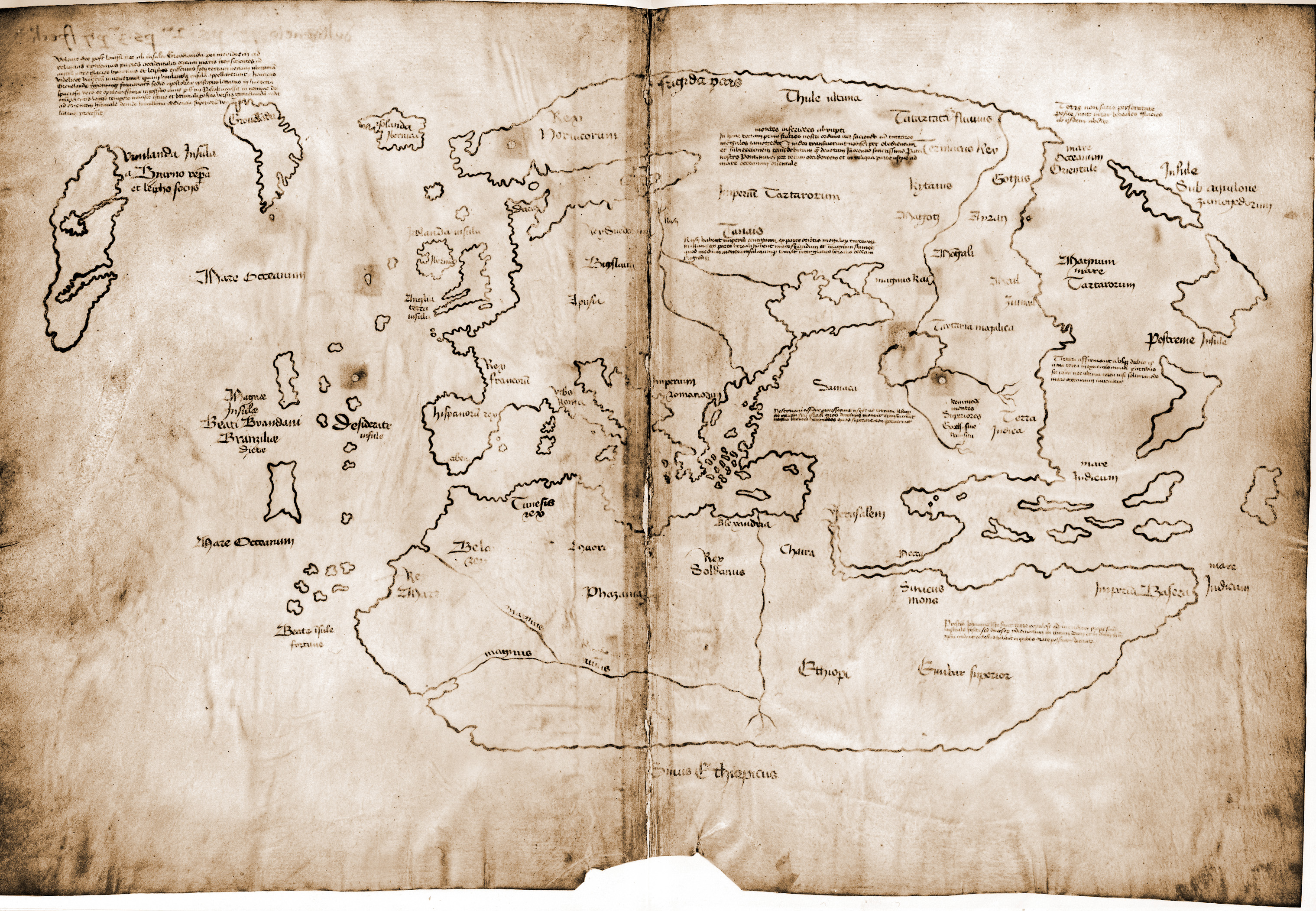
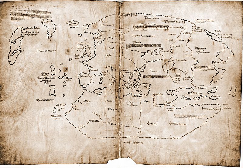
Description: The Vinland map / chart is purportedly a 15th century Mappa Mundi, redrawn from a 13th century original. Drawn with black ink on animal skin, if authentic the map is the first known depiction of the North American coastline, created before Columbus' 1492 voyage. The upper left caption reads: “By God's will, after a long voyage from the island of Greenland to the south toward the most distant remaining parts of the western ocean sea, sailing southward amidst the ice, the companions Bjarni and Leif riksson discovered a new land, extremely fertile and even having vines, ... which island they named Vinland.” Most scholars and scientists who have studied the map have concluded that it is a fake, probably drawn on old parchment in the 20th century.
Title: Vinland Map HiRes
Credit: Yale University, from this website
Author: Yale University Press
Usage Terms: Public domain
License: Public domain
Attribution Required?: No
Image usage
The following 3 pages link to this image:
