
Image: Wednesbury Canal Map SO99SE

Size of this PNG preview of this SVG file: 466 × 599 pixels. Other resolution: 187 × 240 pixels.
Original image (SVG file, nominally 700 × 900 pixels, file size: 130 KB)
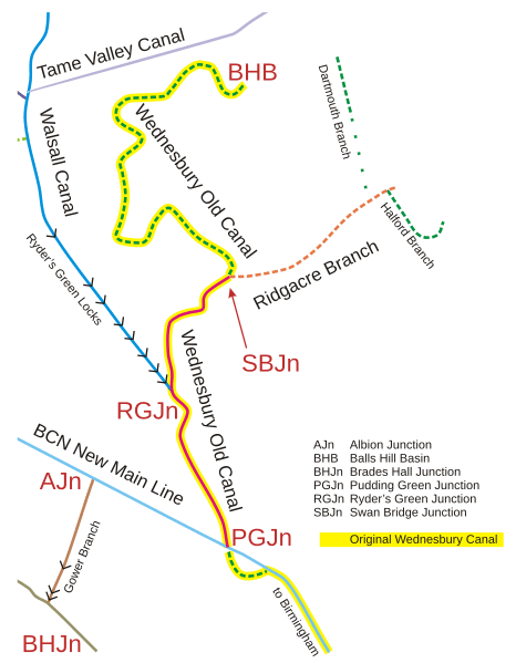
Description: Schematic map of the Wednesbury Canal and its neighbouring canals, West Midlands, England.
Title: Wednesbury Canal Map SO99SE
Credit: self-made from expired-copyright Ordnance Survey map SO99SE, 1955
Author: Oosoom
Permission: You may select the license of your choice.
Usage Terms: Creative Commons Attribution-Share Alike 3.0
License: CC BY-SA 3.0
License Link: https://creativecommons.org/licenses/by-sa/3.0
Attribution Required?: Yes
Image usage
The following 2 pages link to this image:

All content from Kiddle encyclopedia articles (including the article images and facts) can be freely used under Attribution-ShareAlike license, unless stated otherwise.