Ridgacre Branch facts for kids
Quick facts for kids Ridgacre Branch |
|
|---|---|

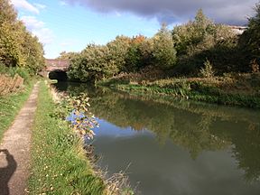
An almost rural view near Black Lake road bridge
|
|
| Specifications | |
| Length | 0.75 miles (1.21 km) |
| Status | watered but disconnected |
| History | |
| Date completed | 1828 |
| Date closed | 1960s |
| Geography | |
| Start point | Swan Bridge Junction |
| End point | Hateley Heath |
| Connects to | Wednesbury Old Canal |
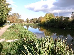
The Ridgacre Branch is a historic canal in the West Midlands, England. It was a smaller part of the Wednesbury Old Canal, which was itself part of the huge Birmingham Canal Navigations network. This canal branch opened in 1828. It was built to help transport coal from mines and goods from iron factories. By the 1960s, it was no longer used. Most of the canal still has water in it today. However, boats cannot use it because a low bridge, part of the Black Country New Road, blocks its entrance.
Contents
How Canals Helped Industry?
The Wednesbury Old Canal was a very important waterway. It was the first part of the Birmingham Canal to open. An official law, called an Act of Parliament, allowed it to be built in 1768. It was meant to be a branch off the main canal between Birmingham and Wolverhampton. But because there were many coal mines at Balls Hill, this branch was built first. It opened in 1769, helping to move lots of coal. The main canal to Wolverhampton opened three years later. The Birmingham Canal became the main route for the growing network of canals. This network was known as the Birmingham Canal Navigations.
Building the Ridgacre Branch
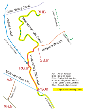
The Ridgacre Branch was one of many canals built to help businesses. It was about 0.75 miles (1.2 km) long. It opened in 1828. The canal started at Swan Bridge Junction on the Wednesbury Canal. This spot is now near the New Swan Lane / Black Country New Road roundabout. The Ridgacre Branch went northeast to a basin and coal mines near Hateley Heath.
As mining grew, more small canals were added.
- The Dartmouth Branch went north for about 0.6 miles (1 km). It also opened in 1828.
- The Halford Branch opened around the same time. It was about 0.5 miles (0.8 km) long. It had tramways connecting its end to the Hall End Colliery.
- The Jesson Branch connected to the Halford Branch. It was named after the mine owner it served. This branch was 0.12 miles (0.19 km) long and opened in 1831.
Why the Canal Closed Down
The Ridgacre Branch and its smaller canals stopped being used after the Second World War. Some parts of the Dartmouth and Halford Branches closed in 1947. In 1954, the Jesson Branch closed. Parts of the Wednesbury Canal also closed in 1954 and 1960.
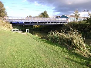
In 1992, plans were made for the Black Country New Road. These plans included a way for boats to pass under the road. This would have been near the Swan Bridge roundabout. The idea was to create a new entrance for the canal. However, when the road was built, the canal was covered over by a bridge. This meant the Ridgacre Branch was cut off from the rest of the canal network. Most of its original length still has water, but its smaller branches are now gone.
Exploring the Canal's Path
Some modern maps show the Ridgacre Branch starting at Ryder's Green Junction. But long ago, the Wednesbury Old Canal continued to Swan Bridge Junction. This is where the Ridgacre Branch truly began. The Wednesbury Canal then went on to the Balls Hill Collieries. This part was often called the Balls Hill Branch.
The Wednesbury Canal reached the junction from the southwest. The Ridgacre Branch then headed east. There was a large gas works on the south side of the canal. To the north, the Wednesbury Canal became wider. It had a short basin to the east and a longer one to the west. These were next to railway tracks. The canal passed under a railway bridge on its way to Balls Hill. Today, the wider part and the western basin still have water. But the old junction is now under the Black Country Spine Road roundabout.
On the Ridgacre Branch itself, a basin to the south served the gasworks. A footbridge crossed this basin. Gas Street crossed the canal on Sandy Gay Bridge. There was another basin just after this bridge. It served the Swan Meadow Swa Mills. Both were still there in 1938. But by 1966, the basin was much smaller. Next, a railway bridge carried the Great Bridge Branch over the canal.
In 1890, a tramway from the Blacklake Colliery crossed the canal. It reached Blacklake Wharf on the south side. But the colliery was no longer used by 1904, and the tramway was removed. By 1966, most of the wharf was gone. However, the area was still used for coal. The next bridge was for the Birmingham, Wolverhampton and Dudley Railway. This bridge is now used by the West Midlands Metro tram system.
Blacklake Bridge carried Blacklake Lane (now the A4196) over the canal. This was east of White's Farm Colliery, where another basin was located. This basin was open in 1890 but not used by 1904. An electricity station had been built on the southern part of the site. The basin was gone by 1920.
On the north side, opposite the basin, the Dartmouth Branch began. It went north, passing under Coles Lane Bridge and Hatchey Heath Bridge. Between these bridges, there were two basins to the east in 1890. There was also one to the west, above which was Albert Street Ironworks. By 1904, the western basin was gone. But a tramway connected the ironworks to the canal. By 1938, houses covered the area east of the canal. Hatchey Heath Bridge carried Witton Lane. Beyond it, Witton Lane Colliery was to the west. A tramway connected the end basin to Crookhay Colliery to the northeast. Balls Hill Colliery was a little further west. Coles Lane, Witton Lane, and Crookhay Lane still follow their old paths. But new houses have replaced most of the old landscape.
Back on the Ridgacre Canal, it continued a short distance past the junction. It ended at a basin. Coppice Colliery was to the north. Coppice Colliery Bridge crossed the canal west of the basin. But this colliery was already closed by 1890. This colliery bridge marks the eastern end of the canal that still has water today. A stream crossed the area near the waste tips. It fed water into the canal through a special gate called a sluice.
Between the bridge and the basin, the Halford Branch turned off and went south. On its east side were the Ridgacre Oil Works, Cyclops Iron Works, Waterloo Iron Works, and Hall End Iron Works. Ridgacre Iron Works was on the west side. By 1904, the oil works became the Hall End Chemical Works. The Cyclops Works was processing soap and tallow.
Church Lane crossed the canal at Ridgacre Bridge. Beyond this, the Jesson Branch continued south. The Halford Branch then turned east. Jesson Bridge crossed the entrance to the Jesson Branch. In 1890, an iron works and Ridgacre Tube Works were on its west side. The workings of a closed colliery were to the east. By 1904, the iron works was a rolling mill. The tube works became the Acme Iron Foundry. The Oriental Tube Works was built on the north side of the next part of the Halford Branch by 1904. A wharf served the Hall End Brick Works. Here, the canal turned north to pass under Church Lane again, at Church Lane Bridge. There was a large basin beyond the bridge in 1890. Tramways connected it to workings to the east and to Hall End Colliery to the north. By 1904, the canal seemed to end before the bridge. The colliery buildings and tramways were gone. By 1966, both the brickworks and the Jesson Branch had disappeared.
 | Dorothy Vaughan |
 | Charles Henry Turner |
 | Hildrus Poindexter |
 | Henry Cecil McBay |


