Inez, Texas facts for kids
Quick facts for kids
Inez, Texas
|
|
|---|---|

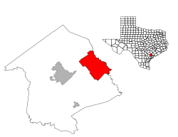
Location of Inez, Texas
|
|
| Country | United States |
| State | Texas |
| County | Victoria |
| Area | |
| • Total | 59.6 sq mi (154.3 km2) |
| • Land | 59.5 sq mi (154.2 km2) |
| • Water | 0.0 sq mi (0.1 km2) |
| Elevation | 66 ft (20 m) |
| Population
(2020)
|
|
| • Total | 2,641 |
| • Density | 44.31/sq mi (17.116/km2) |
| Time zone | UTC-6 (Central (CST)) |
| • Summer (DST) | UTC-5 (CDT) |
| ZIP code |
77968
|
| Area code(s) | 361 |
| FIPS code | 48-35996 |
| GNIS feature ID | 1360007 |
Inez (pronounced EYE-nez) is a small community in Texas, United States. It is a census-designated place (CDP), which means it's an area defined by the government for counting people. Inez is located in Victoria County, about fifteen miles northeast of the city of Victoria.
In 2020, about 2,641 people lived in Inez. The community is part of the Victoria, Texas, Metropolitan Statistical Area. Inez was named after the daughter of a person who helped build the railroad.
Contents
History of Inez
Early Settlements and French Claims
In the late 1600s, a French colony called Fort Saint Louis was built near where Inez is today. This fort was part of France's claim to the land in this area.
How Inez Got Its Name
The community was first known as "Arenosa." This name came from a nearby stream called Arenosa Creek. In 1882, a person named Caleb Janis founded the community. He decided to rename it after Inez Lolita.
Growth and Development in Inez
By 1900, Inez was growing. It had important businesses like a lumberyard and a railway station. There was also a bank, a hotel, a dollar general store, and a Wells Fargo office. A local school helped educate the children in the area. By 1920, the population of Inez had grown to 200 people.
Geography of Inez
Inez is located in southeastern Texas. Its exact coordinates are 28.875316 degrees North and -96.794120 degrees West.
Area and Water Features
According to the United States Census Bureau, Inez covers a total area of about 59.6 square miles (154.3 square kilometers). Most of this area, about 59.5 square miles (154.2 square kilometers), is land. Only a very small part, about 0.1 square miles (0.1 square kilometers), is water.
Location and Roads
Inez is situated northeast of Victoria. It is located along US Route 59 and also near state highway 444.
Population and People
| Historical population | |||
|---|---|---|---|
| Census | Pop. | %± | |
| 2020 | 2,641 | — | |
| U.S. Decennial Census 1850–1900 1910 1920 1930 1940 1950 1960 1970 1980 1990 2000 2010 |
|||
Inez Population in 2020
As of the 2020 United States census, there were 2,641 people living in Inez. These people lived in 805 households, and 698 of these were family households.
Most of the people in Inez are White (about 77.74%). There is also a significant Hispanic or Latino population (about 17.15%). Other groups include Black or African American, Asian, Native American, and people of mixed races.
Education in Inez
Students in Inez attend schools that are part of the Industrial Independent School District. The sports teams for this district are known as the Cobras.
See also
 In Spanish: Inez (Texas) para niños

