
Inniswold, Louisiana facts for kids
Quick facts for kids
Inniswold, Louisiana
|
|
|---|---|

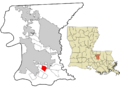
Location in East Baton Rouge Parish and the state of Louisiana.
|
|
| Country | United States |
| State | Louisiana |
| Parish | East Baton Rouge |
| Area | |
| • Total | 2.24 sq mi (5.80 km2) |
| • Land | 2.24 sq mi (5.80 km2) |
| • Water | 0.00 sq mi (0.00 km2) |
| Elevation | 30 ft (9 m) |
| Population
(2020)
|
|
| • Total | 5,987 |
| • Density | 2,672.77/sq mi (1,032.09/km2) |
| Time zone | UTC-6 (CST) |
| • Summer (DST) | UTC-5 (CDT) |
| Area code(s) | 225 |
| FIPS code | 22-37270 |
Inniswold is a community in East Baton Rouge Parish, Louisiana, United States. It is known as a census-designated place (CDP). This means it's an area that looks like a town but isn't officially governed as one.
Inniswold is part of the larger Baton Rouge metropolitan area. This area includes Baton Rouge and its nearby towns. In 2020, about 5,987 people lived in Inniswold. The population has changed a bit over the years. In 2000, there were 4,944 people, and in 2010, it grew to 6,180.
Inniswold is also part of a proposed new city called St. George. This idea came about because people in the area wanted to form their own independent school district.
Contents
Where is Inniswold Located?
Inniswold is in the southern part of East Baton Rouge Parish. You can find it at these coordinates: 30.400658 degrees north and 91.071652 degrees west.
It has clear borders around it:
- To the west, across Bluebonnet Road, is Westminster.
- Jefferson Highway forms its northern border.
- Siegen Lane is on its eastern side.
- Interstate 10 marks its southern border.
You can get to Inniswold from Interstate 10 using Exits 162 and 163. The center of Baton Rouge is about 8 miles (13 km) to the northwest. Inniswold covers a total area of about 2.24 square miles (5.8 square kilometers), and all of it is land.
Who Lives in Inniswold?
| Historical population | |||
|---|---|---|---|
| Census | Pop. | %± | |
| 2000 | 4,944 | — | |
| 2010 | 6,180 | 25.0% | |
| 2020 | 5,987 | −3.1% | |
| U.S. Decennial Census | |||
The population of Inniswold has changed over the years. In 2000, there were 4,944 people. By 2010, the number grew to 6,180. In 2020, the population was 5,987.
In 2020, there were 2,230 households in Inniswold. A household is a group of people living in the same home. Out of these, 1,384 were families.
In 2000, about 32.7% of households had children under 18 living there. The average household had 2.40 people. The average family had 2.97 people.
The people living in Inniswold come from different backgrounds. In 2000, most residents were White (80.48%). African Americans made up 15.25% of the population. There were also smaller groups of Asian, Native American, and other races. About 2.16% of the population was Hispanic or Latino.
The median age in Inniswold in 2000 was 32 years old. This means half the people were older than 32 and half were younger. About 25.6% of the population was under 18.
Education in Inniswold
The schools in Inniswold are part of the East Baton Rouge Parish Public Schools system.
Most children in Inniswold go to Jefferson Terrace Elementary School. A small part of the community goes to Westminster Elementary School. For middle school, most students attend Westdale Middle School. Some students in the eastern part of Inniswold go to Woodlawn Middle School.
When it comes to high school, most Inniswold teens go to Tara High School. A few areas in the east are served by Woodlawn High School.
Images for kids
-
Location in East Baton Rouge Parish and the state of Louisiana.
See also
 In Spanish: Inniswold para niños
