Ira, Iowa facts for kids
Quick facts for kids
Ira, Iowa
|
|
|---|---|
| Country | United States |
| State | Iowa |
| County | Jasper |
| Elevation | 856 ft (261 m) |
| Time zone | UTC-6 (Central (CST)) |
| • Summer (DST) | UTC-5 (CDT) |
| ZIP codes |
50127
|
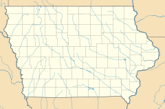
Ira (pronounced like "EYE-ruh") is a small, unincorporated community located in Independence Township, Jasper County, Iowa, United States. This means it's a group of homes and businesses that isn't officially a town or city with its own local government. In 2010, only 29 people lived there, making it a very quiet place!
Contents
The Story of Ira
Ira was officially planned and marked out on a map, a process called "platting," way back in 1883. When it first started, it had a different name: Millard.
How Ira's Population Changed
In 1887, just a few years after it was founded, only 20 people lived in Ira. By 1902, the community had grown quite a bit, with its population reaching 79 people. This shows how small communities can change over time.
Schools in Ira
Students living in the Ira area attend public schools operated by the Colfax–Mingo Community School District.
How the School District Formed
This school district was created when the Colfax and Mingo school districts joined together. This happened on July 1, 1985. Combining school districts can help share resources and provide better education for students in smaller communities.
 | Delilah Pierce |
 | Gordon Parks |
 | Augusta Savage |
 | Charles Ethan Porter |


