
Kingswood, Kingston upon Hull facts for kids
Kingswood is a modern neighborhood in Kingston upon Hull, England. Sometimes people call it Kingswood Parks. It's located on the northern edge of the city.
For a long time, this area was mostly marshy land. People started draining it in the Middle Ages to make it useful. A canal called the Forthdyk (later Foredike) was dug in the 1200s. Later, around 1675, the Engine Drain was created, and windmills helped pump water away. In the 1770s, the Holderness Drain was built, which further improved drainage. Before Kingswood was built, the land was used only for farming.
Kingswood started to be developed in the 1990s. It was built on low-lying farmland next to the River Hull and near the Bransholme Estate. Besides homes, Kingswood has a large shopping area called Kingswood retail park. Here you can find a big Asda supermarket and many other large stores. There are also fun places like a cinema, indoor bowling, and several fast-food restaurants.
Contents
Where is Kingswood?

Kingswood is bordered by the River Hull to the west and Wawne Road to the east. To the south, you'll find the Wawne Drain and Foredyke Stream. The northern edge of Kingswood is where the city of Hull ends and the village of Wawne begins. The western part of Kingswood, beyond the Engine Drain, is often called Kingswood Parks.
The Engine Drain runs through Kingswood from north to south. It creates a clear division within the housing area. There are also green spaces like Midmeredales, which used to be farmland and is now a grassy area with trees. Ings Plantation, a small wood, has been kept within the new development.
Other important features around Kingswood include the Wawne Drain and Foredyke Stream to the south. The A1033 road, known as Raich Carter Way, connects Kingswood to west Hull and Beverley using the Ennerdale Link Bridges. In the southwest, there's a large area for storing water and the Bransholme Surface Water Pumping Station.
Most of Kingswood is less than 5 meters (about 16 feet) above sea level. This means it can be at risk of flooding, especially from the River Hull or heavy rainfall. In 2011, Kingswood had a population of 5,314 people. Most residents were white, and about 67% of people had jobs, which is similar to the national average.
Kingswood's Past: From Marsh to Modern Estate
How the Land Changed Over Time
For thousands of years, the land east of the River Hull was mostly marshland. Only higher spots had villages. The southern part was often flooded by the sea, making the water salty. The northern part was swampy but had fresh water.
In the Middle Ages, people started building defenses against floods. They dug ditches to drain the marshes and made canals for boats. The Forthdyk (now Foredike Stream) was dug in the early 1200s. It was used as a waterway and also helped drain the land. There was even a watermill near the river, powered by the tides. Evidence shows that people lived and worked in the southwest part of the area during this time.
Around 1675, the Engine Drain was dug to improve drainage, and windmills were used to pump water into the River Hull. In the 1760s, a law allowed more drainage work. This included building the Holderness Drain and raising the banks of the River Hull to prevent flooding. This work cost a lot of money but greatly improved the land.
By 1850, the area where Kingswood now stands was mostly rectangular fields with many drainage ditches. There were only two farms, Ings Farm and Gibraltar, near the River Hull, and another farm called South Field. There were very few roads, mostly just farm tracks. This farming landscape stayed the same for about 100 years.
In 1968, part of Wawne parish became part of Hull. Gibraltar farm was taken down in the early 1970s. Around this time, the Bransholme Estate began to be built south of the Wawne/Foredike Drain. The first building in the future Kingswood area was Broadacre County Primary School in the late 1980s.
Building the Kingswood Estate
.jpg)
Kingswood started to grow in the 1980s around Kesteven Way, as an extension of northern Bransholme. In 1989, Hull City Council and developers decided to work together to build on the land west of Wawne Road, north of the Foredike/Wawne Drain, and east of the River Hull. They got permission in 1994, expecting the whole area to take 15 to 20 years to develop. The development area was about 320 hectares (790 acres).
A big step for Kingswood was building the Ennerdale Link Bridges over the River Hull in 1997. These two bridges allowed the Raich Carter Way (A1033) to connect to the main roads leading to Beverley.

By 2003, a lot of Kingswood had been built. The Kingswood Retail Park was finished, with an Asda supermarket (built in 1996) and stores like Matalan and Boots. The Kingswood Leisure Park had a David Lloyd Leisure center (1999), a UGC cinema (2000), and a Hollywood Bowl bowling alley (2003). About 400 new homes had been built, adding to the 1,000 homes already around Kesteven Way. The city planned for Kingswood to have about 12,000 people living in 5,000 homes, with 4,000 jobs.
In 2007, some parts of Kingswood experienced flooding. This happened to homes built under the older 1994 plans. Newer homes, built with better flood protection after 2004, were not flooded inside. The main reason for the flood was a problem at the Bransholme Surface Water Pumping Station.
.jpg)
By 2011, about 2,270 homes had been built in Kingswood. In 2013, the Kingswood Academy school opened. By early 2015, 3,576 homes were in Kingswood, with many more planned.
The "village center" of Kingswood started to be built around 2008 with the Kingswood Health Centre. In 2014, Kingswood Parks Primary school opened. A Co-op store also opened in the village center.
In late 2015, work began on a large Next plc store. However, plans for even more shopping facilities were stopped in 2016 due to concerns about their effect on other shopping areas in Hull.
In mid-2016, permission was given to build 750 new homes in an area called "Wawne View". This development is expected to have over 1,600 homes in total and will take about ten years to build.
Images for kids
-
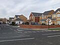
Typical Kesteven estate housing, Bowmont Way (2008)

