Hunua Ranges facts for kids
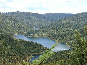
The Hunua Ranges are a group of hills located southeast of Auckland in New Zealand's North Island. These ranges cover about 250 square kilometres. A large part of this area, 178 square kilometres, is parkland. The highest point in the ranges is Kohukohunui, which stands 688 metres (2,255 feet) tall.
The Hunua Ranges are very important for Auckland's water supply. Many reservoirs here collect water for the city. The ranges are also home to many rivers and streams. One popular spot is the Hunua Falls on the Wairoa River, which is a favourite place for both tourists and local people to visit.
The ranges are about 50 kilometres (30 miles) southeast of Auckland. They are located near the western shore of the Firth of Thames. Not many people live in the Hunua Ranges. Most of the area is part of the Waharau and Hunua Ranges Regional Parks. The small town of Hunua is found at the foot of these ranges.
History of the Hunua Ranges
For a long time, the Māori people used parts of the Hunua Ranges. Early European visitors found clear areas that had been used as gardens. The Ngāi Tai people are the traditional guardians of this land. Some old Māori sites have been found here. After the New Zealand Wars, the main part of the ranges was taken by the government.
Early European settlers used the ranges for cutting down trees to get timber. They also tried farming, but the soil was not very rich, so it was hard to grow crops. In the past, people also mined for manganese here. There were also attempts to find gold, but no valuable gold deposits were ever discovered.
Kohukohunui Peak
Kohukohunui is the highest point in the Hunua Ranges. It reaches a height of 688 metres (2,255 feet). The name Kohukohunui means "great mist" in Māori. This name was given by the New Zealand Ministry for Culture and Heritage.
Water for Auckland City
Since the 1920s, the Auckland City Council began buying land in the Hunua Ranges. They used money from their water supply operations to do this. Building the water supply system started in the late 1940s. The first of four dams, Cossey's Dam, was finished. It could hold 11.3 million cubic metres of water.
Three more dams were built later:
- Mangatawhiri Dam was completed in 1965.
- Wairoa Dam was completed in 1975.
- Mangatangi Dam was completed in 1977.
Together, these four dams can hold 77.1 million cubic metres of water. They provide about 68% of Auckland's drinking water. This water is treated at the Ardmore Water Treatment Plant before it goes to homes.
In 1964, the water supply operations and the land were given to the new Auckland Regional Authority. This authority finished building the water supply system. They also continued planting non-native trees in some northern and western areas. The City Council had started this tree planting. The Authority's Water Department managed the land.
In 1992, the water operations became a separate company called Watercare Services. However, the land itself stayed with the Auckland Regional Council. Watercare took ownership of the water-related equipment and buildings. They also leased the reservoir areas and operational areas from the Auckland Regional Council for a long time. The land with the non-native trees was leased to another company. The rest of the land that collected water became regional park land.
In November 2010, the southernmost part of the Hunua Ranges was moved into the Waikato region. This changed the local government boundaries. However, the ownership of the former Auckland Regional Council park land went to the Auckland Council. The ownership of the water assets remained with Watercare Services.


