Komuniga Island facts for kids

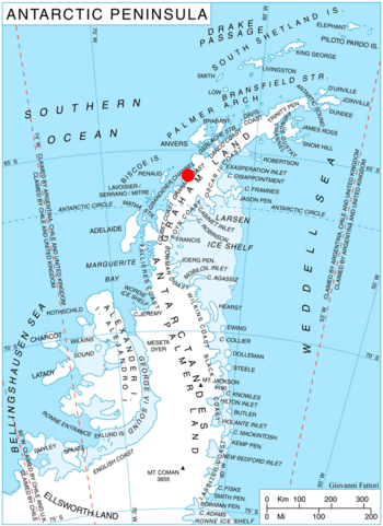
Location of Magnier Peninsula on Graham Coast, Antarctic Peninsula
|
|
|
Location in Antarctica
|
|
| Geography | |
|---|---|
| Location | Antarctica |
| Coordinates | 65°43′27″S 64°23′37″W / 65.72417°S 64.39361°W |
| Administration | |
| Administered under the Antarctic Treaty System | |
| Demographics | |
| Population | Uninhabited |
Komuniga Island (which is ostrov Komuniga in Bulgarian) is a small island covered in ice. It's about 1.3 kilometers (0.8 miles) long and 1.1 kilometers (0.7 miles) wide. This island is the most southern part of the Correo group.
You can find Komuniga Island in Bigo Bay, which is along the Graham Coast in Graham Land, Antarctica. It's located just off the southwest coast of the Magnier Peninsula.
This island is quite new! It appeared as a separate piece of land in the early 2000s. This happened because the ice cap on the Magnier Peninsula melted and pulled back. The island gets its name from a place called Komuniga in Southern Bulgaria.
Where is Komuniga Island?
Komuniga Island is located in a very cold part of the world: Antarctica! It is about 1.3 kilometers (0.8 miles) northwest of the closest mainland area. It is also 500 meters (0.3 miles) southeast of another island called Baurene Island.
British explorers mapped this area in 1971.


