Kuskulana River facts for kids
The Kuskulana River is a cool waterway in the U.S. state of Alaska. It flows through the amazing Wrangell–St. Elias National Park and Preserve, which is a huge area of wild nature. This river is known for its beautiful views and the famous Kuskulana Bridge that crosses it.
Contents
Geography
Where the River Begins and Flows
The Kuskulana River starts high up in the mountains, from the Kuskulana Glacier. Imagine a giant river of ice! This glacier is about 11 miles long. The river begins at an elevation of about 2,200 feet, which is like starting from the top of a very tall building.
It then flows southwest for about 21 miles. That's a long journey! The river eventually joins the Chitina River, which is another big river in Alaska. The land around the river, especially higher up, is very rough and mountainous.
The River's Journey and Landscape
For the first 10 miles of its journey, the Kuskulana River flows through a wide, flat area filled with gravel. Tall mountains stand on both sides, making the scenery incredible.
Further down, for about 11 miles, the river cuts through a deep canyon with steep rock walls. It's like the river carved its own path through solid rock!
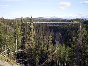
The famous Kuskulana Bridge crosses this canyon. The railroad tracks on the bridge are about 220 feet above the water. That's taller than many buildings! At the bottom of the canyon, the river is about 70 feet wide.
During winter, the river can get very low. In some places, especially where the ground is loose, parts of the river might even dry up. The river gets most of its water from the Kuskulana Glacier. This means the water often carries a lot of fine sand and silt from the glacier.
Tributaries
Smaller Streams Joining the River
A "tributary" is a smaller stream or river that flows into a larger one. The Kuskulana River has several smaller streams that join it.
One of the biggest is called Nugget Creek. It flows into the Kuskulana River from the west, just below the glacier. Nugget Creek drains an area of about 12 square miles. It also drops about 800 feet in its last 2 miles, meaning it flows downhill very steeply!
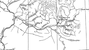
Another important tributary is Strelna Creek. It starts in the mountains at an elevation of 6,000 to 7,000 feet. Strelna Creek is about 12 miles long and joins the Kuskulana River a few miles before it meets the Chitina River.
Strelna Creek doesn't have glaciers feeding it. So, its water flow in the summer depends on rainfall and melting snow from the mountains. Sometimes, in very cold winters, this creek can also dry up.
 | Tommie Smith |
 | Simone Manuel |
 | Shani Davis |
 | Simone Biles |
 | Alice Coachman |


