La Libertad, Comayagua facts for kids
La Libertad (pronounced "la lee-ber-TAHD") is a special type of area called a municipality in Honduras. It is located in the Comayagua Department, which is like a state or province within Honduras.
As of 2015, about 27,036 people live in La Libertad. The municipality covers an area of around 320 square kilometers (about 123 square miles). It's a place where people live and work, and it has its own local government.
Quick facts for kids
La Libertad
|
|
|---|---|
|
Municipality
|
|
| Country | |
| Department | Comayagua |
| Area | |
| • Total | 320 km2 (120 sq mi) |
| Population
(2015)
|
|
| • Total | 27,036 |
| • Density | 84.5/km2 (219/sq mi) |
Where is La Libertad?
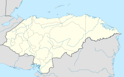
La Libertad is located in the central part of Honduras. It is part of the Comayagua Department. This department is known for its rich history and beautiful landscapes.
The exact location of La Libertad can be found using coordinates: 14 degrees 45 minutes North and 87 degrees 37 minutes West. These numbers help pinpoint its place on a map.
What is a Municipality?
A municipality is a type of local government area. It is like a town or a small region that has its own leaders. These leaders help manage services for the people who live there.
They might be in charge of things like local roads, schools, or public services. In Honduras, municipalities are important for organizing communities.
People and Area
As of 2015, La Libertad had a population of 27,036 people. This means that many families and individuals call this place home. The number of people living in an area is called its population.
The total area of the municipality is 320 square kilometers. This measurement tells us how much land the municipality covers. It helps us understand the size of the community.
See also
 In Spanish: La Libertad (Comayagua) para niños
 | Dorothy Vaughan |
 | Charles Henry Turner |
 | Hildrus Poindexter |
 | Henry Cecil McBay |


